On May 3, 2018 Kilauea Volcano erupted in the East Rift Zone area outside the Volcanos National Park boundaries. A series of fissures developed along a fault line between the towns of Volcano and Pahoa. Most of them just bubbled up spitting out enough lava to cover a few acres and then quit, but there were a few that came forth with a vengence. There were some 24 different fissures identified and fissure 8 initially was the most active. Then fissure 8 showed signs of relenting as fissure 22 put on a show of shooting lava to 160 feet high.
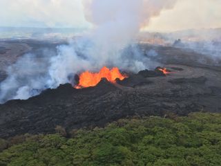
Then , towards the end of May, fissure 22 subsided and fissure 8 opened up to build a spatter cone over 100 feet tall.
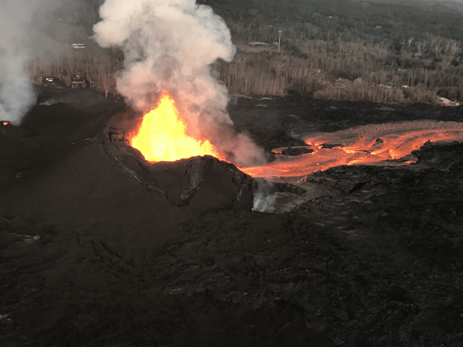
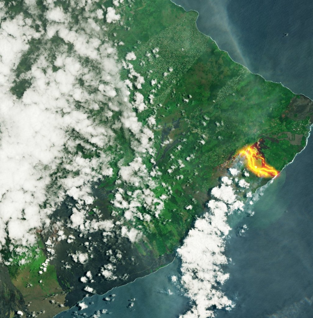
The lava flowed from fissure 7 and 8 (which had combined) to form a river that reached a half mile wide and extended through Vacationlands and consumed Kapoho Bay – extending the shore line over a mile out into the ocean. In the process, this eruption created over 800 new acres of land and destroyed over 700 homes.
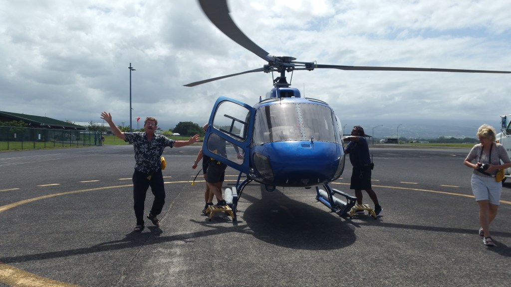
Other than searching for real estate, we wanted -OK, I wanted – to see the lava coming out of the ground and flowing into the ocean. I felt that it would not be often to be able to witness a volcano in the process of erupting and didn’t want to miss this potentially once in a lifetime experience. We booked tickets to return to the big island and scheduled a helicopter tour over the volcano.
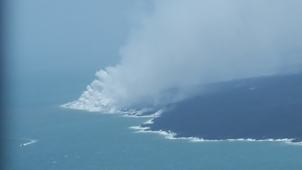
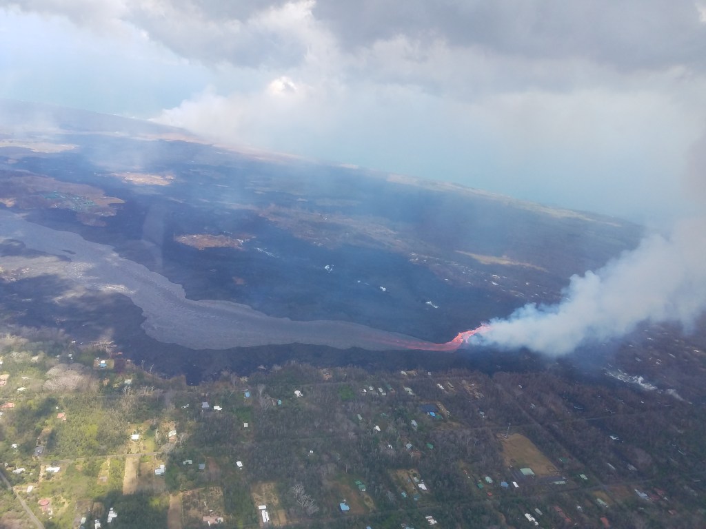
We left the Hilo airport and flew down to the SE corner of the island and then out over the ocean. We followed the coast line heading west and could see two distinct columns of white/gray smoke/steam in the distance. One marked the location of still active fissure 8, and the other was at the shore line where the lava was spilling out into the ocean.

There was a huge semi-circle in the water surrounding the area where the lava was entering the sea. Almost a perfect bouy line but without the bouys showing the changes to the water resulting from the lava. The ocean outside the circle was a beautiful dark blue, and inside was a sickly brown and sludgy green. White clouds of steam were billowing into the air for miles along the shore.
Then the helicopter followed the brown fluid lava river as it snaked across the island back to the spatter cone at fissure 8. I don’t know how long this river was as it traveled to cross the 10 to 20 miles from shore where the fissure erupted. As we hovered near the fissure, the bright red and orange lava was boiling out of the ground and created a bright red/orange river for several hundred yards before it changed color as it was cooling to the brown/black of the fluid river of lava.
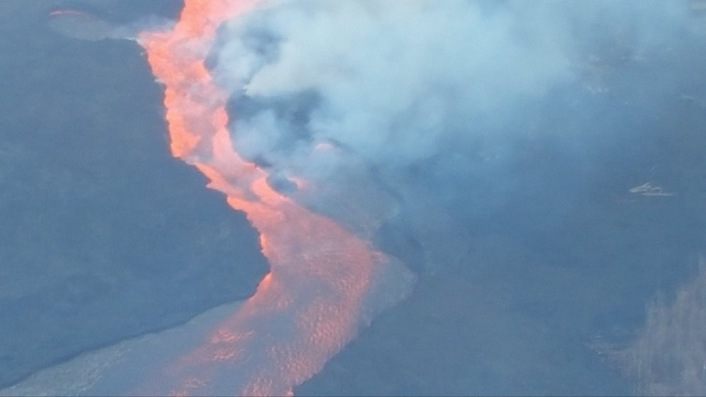
As I looked closer at the river, I could see a red line at the banks on each side. This corner of the island was – and still is – a tropical green paradise. Now it has a black/brown swath cut through it perhaps a half mile wide with the vegetation on both sides either burnt or brown and dead for 200 to 300 yards. The contrast between the lush green area and the lava zone is distinctive and truly awesome. Pictures and words cannot possibly describe the amazing power of this lava flow. Nothing man can do will stop it, or contain it.
Back on the mainland and in other places in the world, the way the media has portrayed this event makes people think that the entire island is on fire, and everyone has been evacuated. In reality, over 95% of the island is unaffected – life goes on as before – except of course, for those whose homes have been destroyed.
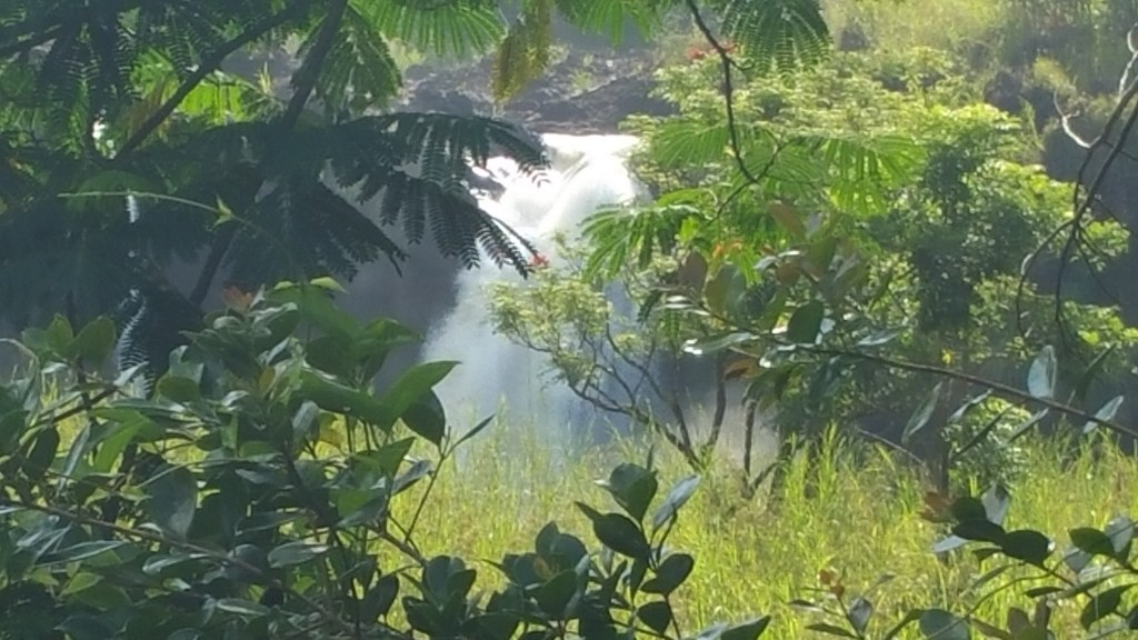
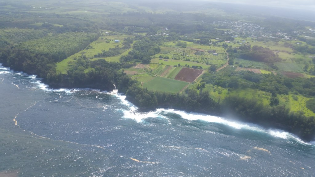
After circling the devastation caused by this eruption, we headed north to the east coast of Hawai’i. This area of the island is lush and green, with tall tropical jungle vegitation growing everywhere there is not someone to cut it back. There are a number of waterfalls in this area, and we flew along the coast and were able to see a few.

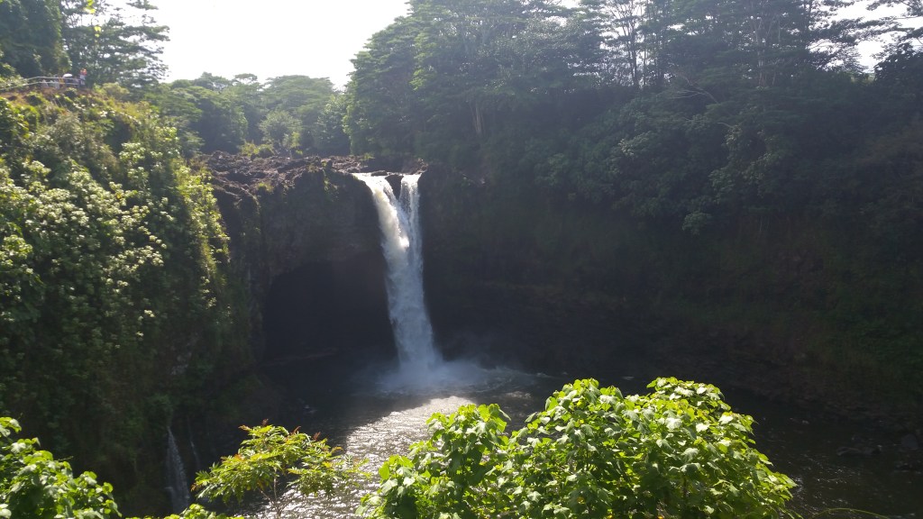
After the helicopter landed at Hilo International Airport, we drove into Hilo and went to visit a few of these waterfalls we had seen from the air. Our first stop was at Rainbow falls, located not to far from downtown Hilo. Legends and stories abound of the expliots of King Kamehameha here, but the falls are truly beautiful to see.
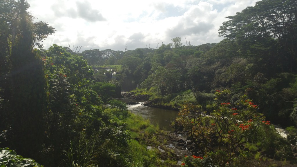
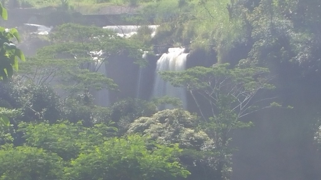
Upstream from Rainbow Falls a few hundred yards, there is a section of the river known as “Boiling Pots”. We got there by driving through a subdivision about a quarter of a mile. There is a small park with a couple of picnic tables, restrooms, and a large green lawn between the parking lot and a viewing area where you can see why they call this “Boiling Pots”. During the rainy season, these pots truly are boiling. Apparently people have died trying to swin here, so they warn you to stay out of the river. It would be quite a hike to get down to the river in the first place, so not many people disregard this advice. But there always are the few.

From the park, we drove up towards the mountain further inland and came across a couple of bridges. We would park at one end or the other of each of these bridges, so that we could walk back onto the bridge and look upstream and down and saw many other waterfalls.