“Arizona’s Beach” is located three to four hours south of Phoenix (depending on who is driving). Affectionately known as Rocky Point, this town is in the upper section of the Gulf of California. After a drive through the lovely town of Gila Bend, and past the military gunnery range, through the Organ Pipe Cactus National Park, then you cross the border at Lukeville and into the town of Sonoita. The radar guns that the police in Sonoita have are all fixed on 40 MPH so that when they see a gringo (someone with license plates other than Mexico), they pull them over and tell them that they were speeding through Sonoita where the speed limit is 20 mph. Your options are to go with them to the police station and wait until the Judge arrives (four to six hours) or pay the “fine” of anywhere between $40.00 and $80.00.
After successfully navigating the gauntlet at Sonoita, it is a relatively straight shot through the desert to Rocky Point.
On the way back to Arizona one time, we came up to a traffic jam in the National Park. It had been raining in the area quite heavily. All of the washes were running with water,
and one had washed so much sand onto the roadway that the Highway Department had to bring in heavy equipment to clear the road. Of course, this brought traffic to a stand still for about an hour.
Rocky Point is a fishing village that has evolved into a tourist trap. Many Americans have gone there for a weekend getaway. In fact, North and west of Rocky Point is the development of Cholla Bay that is kind of like the original Ex-Pat hideout. Now there are many developments south of the town that dwarf Cholla Bay.
To the north of Cholla Bay, about ten miles outside of Puerto Penasco, on the road to El Golfo, is a development called Laguna Shores. There are many developments along this stretch of road, but this particular one, we had the opportunity to stay there a few times. It is a development of home sites with a common olympic sized swimming pool on the beach, and a restaurant on site.
The poolm is on the right. there are day beds, lounge chairs, and kayaks for use on the beach.
The idea is for individuals to purchase the lots and build a house that meets the requirements of the developers. They have plans for an 18 hole golf course, but when we stayed there the golf course was still in the planning stages.
They had developed a few condo buildings with four or five units per building – each one a two or three bedroom unit with a full kitchen and two or three bathrooms. Typically 1600 to 2000 square feet. There were about eight or ten homes built in the development, and a four story apartment building with four or five units on each floor. A rather nice development.
Looking across to Cholla Bay
They would rent these condos to prospective buyers. We purchased a packaged deal where we could stay there for five weekends – three days and two nights, check in on Friday, and check out on Sunday. Very peaceful. Swim in the pool or the ocean/gulf. Walk along the beach. North of the property about a quarter of a mile was a place where there was a small estuary. The sand piled up next to the estuary and thousands of large shells piled up here.
When the tide went out, the shore extended out about quite a ways, so that it would take twenty to thirty minutes to walk out to the water’s edge. Then a few hours later, it would be back up near the pool.
The tide is out
Another place we contemplated purchasing for our “shack on the beach”
This post is a rather long post. It is a daily log of my three plus weeks in Hawai’i.
Monday – March 22, 2021
So far, so good – no major mishaps so far on this trip – only a few minor ones.
This morning I woke up and went on line to the Delta app and paid for two checked bags. I weighed them at home with the bathroom scale. One weighed 50 lbs and the other was 48. Both are a bit close to the 50 lb limit, but it should be OK.
The line at the service counter at the airport was rather long, but it moved quickly as they had every booth manned with an agent to assist. I would guess that there were about 100 people in front of me in line, but my wait was only about five minutes. Before getting in line, I weighed both bags on the provided scale – 50.5 and 49.5. A little juggling and I was set. With both bags checked, I headed off to TSA. No problems here. Usually they pull my bag aside for further inspection, but this time both bags came through just fine. I was worried about having two pipe clamps in the carry on, but they didn’t say a word. They pulled both bags for the lady behind me – I think they were after mine, but missed.
The flight from Phoenix to LA was uneventful, but the terminal area we pulled up to looks like a major construction project. I would think that this pandemic would have slowed down air traffic to the point that the future of air travel would not justify the millions they are spending. Further evidence that this entire pandemic is a political ploy. We got off on an exterior stairway and rode shuttle busses to the terminal.
The gate for my flight from LAX to Kona is within 100 yards of where the shuttle drops us off. I have time to grab a greasy burger and fries. One pleasant note about the flight from Phoenix was the boarding process. They boarded according to seat number – from back to front. Meaning, they called for the passengers in the last three rows to board the plane first. Then the next three rows, then the next three, etc. There was no crowd inching forward to be first in line when their “zone” was called, but more importantly, the person in seat 10C was not blocking the aisle in the plane when the passengers in the seats behind were trying to board. What a novel idea! I imagine that they are doing this to comply with “social distancing”. So far, one of the few positives to come out of this pandemic.
They followed this same procedure in LA. Again, it was much more orderly, more calm, and by far easier.
According to the flight tracker on the screen on the seat in front of me, we are about 45 minutes from Kona. We have filled out the Hawaii Agriculture forms that no one will ever read. I have my negative test result from my covid-19 test, my QR code from the Population Control website reminiscent of the George Orwell novel 1984 (aka Hawaii Travels)
Everything is in order – everything is going according to plan – so why do I have a feeling of dread? Why am I filled with anxiety over this trip?
Arrived in Kona at 4:00 PM. Went through the Covid-19 gauntlet. Every time I come, it appears a bit more sophisticated. They have really learned that spreading the panic is beneficial to more governmental control.
They now have their own testing lab set up on site and everyone who arrives gets the same new form of “Aloha” greeting – “Welcome to Hawaii, now let me shove this cotton swab up your nose . . . twice!” The next thing will be “Drop your trousers and bend over so I can shove my fingers up your ass while I grab your balls with my other hand and tell you to turn your head and cough!” The new “Aloha”.
Stopped off at the lumber store for concrete, spray paint, 1/2″ plastic pipe and elbows, 20′ rebar, 2 – 2x4x8 and 1 -2x6x8. The concrete and the rebar is for gate posts; the plastic pipe and elbows are for a solar water heater; the lumber is for more doors for the shed. Using the hacksaw I brought, I cut the repar into lengths I could haul in the rental car.
Stopped off at KFC for dinner.
I had contacted someone on line who was selling a Kohler undercounter sink and faucet. I called the phone number when I was leaving the lumber store – told them I was going through South Kona in about an hour and asked if we could meet and I could purchase this sink. The woman said that she was actually closer to Ocean View than Kona – told her that I was headed to Naalehu and would be going right past. She said that would be fine and we discussed a location on the highway out in the middle of nowhere to meet. She arrived a few minutes after I did. It was quite dark as it was about 8:00 PM. I got out of my car and approached her as she was walking to the back of her truck. She got rather hysterical and said, “Stay back! You aren’t wearing a mask!” She put the sink in the truck of my car and I handed her the money. She grabbed the money and made a beeline for her truck to get as far away from me as quickly as possible. I didn’t have time to warn her that the Presidents on the bills I gave her weren’t wearing a mask either!
Tuesday – March 23, 2021
I set up my “kitchen”. I got out the propane stove and placed it on the pile of pallets, got out my cooking pans and dishes. I installed the tarp over the area where the pallets were stacked. I placed the two individual inflatable solar lights out in the sun to absorb energy. Had a bowl of cereal for breakfast. After I unloaded the lumber and concrete from the rental car, I went for a scenic drive.
Former sugar cane fields with Kileauea in the background
There is an upper road between Na’alehu and Pahala. It rises to about 2,000 feet in elevation and in many places you can see down to the south coastline.
To get to this road, I turned off the highway in Na’alehu on a road that passes between the hardware store and the Punalu’u Bakery. This road goes up past the Na’alehu cemetary where they have a sign warning about an epidemic of Dengue Fever. From there it winds up the side of the mountain past the old sugar cane fields that now are grazing pasture for cows.
Former Hutchinson Plantation sugar cane fields – now cow pastures.
There are odd clumps here and there in the pasture land of what looks to be sugar cane. This was a nice easy leisurely drive along a country road with some nice scenery.
Upon returning to the property, I proceeded to get the rental car stuck as I backed it too far down the driveway. I didn’t think the slope was too much, but the combination of loose material, slick surfaces, and too short of a distance to get enough momentum to get up out of there was too much for the two wheel drive Nissan Rogue. I called up a neighbor down the road a ways and he said he wasn’t very busy today, and he could be there in just about ten minutes or so. I had heard that somewhere before as it has a familiar ring to it, but sure enough, he and his oldest son came by and pulled the car out with a four wheel drive truck.
I took the solar panels out of the shed and placed them on the roof, tying them in place with some small ropes. I drilled a hole through the roof for all the wires. Hooked up the batteries to the charge controller and the solar panels to the controller as well. They started producing electricity for the batteries instantly. I hung up the lights I had brought in the corners of the shed and ran the wires to the switch box, and hooked up the switch box to the batteries. I tested them and they all worked. Success!
Later, I drove in to Hilo to purchase some more concrete for the gate posts. I would find as I build these posts that it will take more concrete than I had initially thought. I also picked up the lumber to build the framework for the gates. Then I contacted an individual who was selling used solar panels on line. I went to Hawaiian Paradise Park (HPP) and picked up two panels originally rated for 75 watts each. Not bad for $40 each.
Wednesday – March 24, 2021
I retrieved the Ford Escape from the neighbor’s back yard. Removed the tarp I had covered it with, climbed in and inserted the key. It started right up. No dead battery. I put it into drive and it moved out from under the tree where I had parked it and onto the level higher area of a driveway. I got out and looked at all four tires. None of them were flat. I was worried that one or both of the rear tires would be flat and that the battery would be dead. Worrying for no reason. Need to stop worrying.
I worked on clearing out the branches from below the first deck. Previously, I had trimmed the branches from the trees above this area and just let them fall helter skelter into a huge pile. After clearing out the branches, many I moved out to the end of the driveway to use as fill, I started pulling out the rocks. I want to create a garden here by building a series of rock walls to create a terraced effect.
After clearing and building rock walls
Around noon, I drove the rental car into Hilo and returned it to the airport. Then I called Uber for a ride to WalMart to catch the bus back to Na’alehu/Waiohinu. I got off the bus at the Wong Yuen Chinese store in Waiohinu, that is no longer operating.
Then I proceeded to walk back to the property. I figured it was about 2 miles. It took me an hour and 15 minutes – most of it up hill.
Upon returning to the property, I worked a bit more on moving rocks from the new garden area, and then fixed dinner.
When I went to bed, it was comforting to have lights I could turn on with a switch.
Thursday 3/25/2021
Went to Ocean View to buy ice and sugar. Stopped at the county water station on Lehua Street to fill up my jugs with water. When I got back to the property I began to dig out the footings for the gate posts. I cut some rebar pieces for reinforcing in the footings as well as for uprights. After digging the holes for the footings, I started mixing the concrete for the footings. As I reached into the car for the water I had collected this morning, I saw my bag of ice sitting in a puddle of water! DANG! (OK, I didn’t really say dang)
After putting what was left of the ice in the ice chest, I continued mixing the concrete and poured the footings. Then I gathered together some cast off boards to be used as forms for the columns. I tried to build boxes 18″ by 24″ that were 16″ tall to be used as moveable forms. My idea was that after pouring one 16″ tall section, I could move the form up to prepare for the next section.
Under this wooden box is a concrete footing about the same size as the box. I hope it will be big enough.
I then continued clearing out the branches below the 12 x 12 deck and building rock walls for the tiered gardens. I used the power inverter attached to the batteries in the solar system all afternoon to charge the batteries for the cordless tools. Having lights at night that turn on with the flick of a switch is wonderful!
Friday – 3/26/2021
Breakfast – scrambled eggs and sausage.
Finished moveable forms for gate posts – posts to be 18″ square – form is 16″ tall. I will pour the posts in 16″ lifts. I’ll let the concrete cure overnight then raise the form. Once the form is in place, I line the inside of the form with rocks and fill the area inside the rocks with concrete. The rocks will be/should be visible when the form is removed. I set up my computer and was able to answer emails etc in the evening.
Saturday – 3/27/2021
Spent most of the day working on clearing out dead branches from below the original deck. Started on building rock walls.
Sunday – 3/38/2021
Continued moving old branches to driveway area where I cut then into 6″ pieces. More rock wall building.
Monday – 3/29/2021
Put the starter pull assembly back on the chipper. Put in gasoline and started the chipper. There was a loud banging noise coming from the chipping wheel area. Shut off the chipper, and proceeded to disassemble it.
One of the hammers in the chipper has come loose. The set screw has fallen out and it is hanging at an angle, flopping and banging. I was able to get it off and took it in to the hardware store in Ocean View. They didn’t have a screw that would work, but I was able to get a heavy cotter pin that I slid into the hole in place of the set screw and through the pivot. This held the hammer in place. I ran the chipper for a couple of hours creating quite a pile of wood chips until it quit. I could get it to start, but it acted like it immediately ran out of gas. I need to clean the carburetor. Not today, maybe another day. Maybe I can just install the new one.
Tuesday – 3/30/2021
Worked on clearing out the branches piled up downhill from the original deck. Previously, on other trips, I had cut branches from trees in this area to increase the view and maybe get a view of the ocean from the deck. I had just cut them and let them fall helter skelter into a huge tangled mess. Today, I continued trying to clear out this mess. My intent is to build rock walls to make terraced gardens in this area.
As I was pulling on some branches, I saw something moving very slowly within the branches.
It was a Jackson Cameleon. He is about 8 to 10 inches long, a bright green body with a darker green tail and with other colored markings, and two horns on his head pointing forwards and one on his nose. FABULOUS! I worked around him to remove the branches so I could get closer to him. Luckily, they move very slowly, so I was able to keep an eye on him. As I was working on the branches around him, I saw something else that I didn’t expect – but I should have.
It was a female Jackson Cameleon. WOW! She was a little smaller, maybe 7 to 9 inches long, with a bright green body and darker green markings much like a giraffe. I was able to get the branches cleared from around these two, and capture them by grabbing the branches they were hanging onto. I transferred these two to a large pile of branches in the northwest corner of the property where they would be safe. Then as I was finishing, I saw a third one. This was the baby. It was maybe 4 inches long and light grey with darker grey markings. He blended in so well to the branches, that I lost sight of him, and could not transfer him up with momma and papa.
Wednesday – 3/31/2021
Found baby Jackson Cameleon. Caught him (it has horns, so I assume it is a male) and placed him up in the pile of branches where I had released the other two yesterday. These two are nowhere to be seen, so I can only hope for the best.
Thursday – 4/1/2021 – April Fools Day
This morning I had malasadas from Punalu’u Bakery in Na’alehu. They are basically sugar donuts without the holes, or in reality, they are large sugar coated donut holes. They also slice these open and insert filling – strawberry, apple, custard, etc.
More branches still to remove
I had an easy day today. I worked on removing rocks from my new terraced gardens and reinforcing/building the rock walls directly below the original 12 x 12 deck.
Friday – 4/2/2021
Changed oil in the car/ Ford. Oil drain plug was stripped. The shoulders on the bolt were rounded off so a wrench would not turn the bolt. I raised the car up on cement blocks so it was stable enough to get underneath it. That was a chore in itself! I tried different sizes of wrenches, different types of wrenches, I even tried a small pipe wrench, but the bolt would not budge and every wrench kept slipping off. So, I used a hammer and a chisel. No, I did not cut the bolt off with the chisel . . . I used the chisel to create a niche in the outside of the bolt. Then, with the chisel in this niche, I was able to drive the bolt in the direction to loosen it. I was able to get the bolt to turn, and then to unscrew. I drained the oil and used a screw driver driven through the oil filter to unscrew the oil filter. I installed the new oil filter and reinstalled the bolt. I wish I had a new bolt to replace this with, but I’ll have to get one from the mainland the next time I am there. Then I filled the crankcase with oil. Success.
I also found a new place for obtaining water in Waiohinu. At the park, there are only two spigots. At this station, there are 7 or 8. It is at the garbage transfer station as you are going out of Waiohinu towards Ocean View.
I also took a shower. I have filled eight to ten 2 liter soda bottles with water and placed them out in the sun.
My Solar Water Heater.
They heat up and in the afternoon around 3:00 PM I have water hot enough to take a shower by pouring the water from the bottles over me as I stand on a wooden pallet.
Saturday – 4/3/2021
I worked on another lift of the gate posts. I was one pipe short for the hinge pivots – I actually had the pipe, it just was not threaded, so I had the hardware store in Ocean View put threads on both ends. Then I used two elbows – one buried inside the post so the pipe cannot be pulled out through the concrete. I also planted the onions and the potatoes I had left from my previous trip – they had sprouted. I planted them in the corner of my new terrace garden.
Easter Sunday – 4/4/2021
I worked on the gate columns. One is at about 5′ tall. All it needs is the cap.
I have been installing 1/2″ pipes in the concrete with an elbow sticking out of the side of each column, one about a foot off the ground, and one about 8″ from the top to be used as the pivots for my gate hinges. I will install two eye bolts in the side of the gates at the correct heights to pivot on the tops of the elbows. The one post that is 5′ tall only needs a concrete cap. The other one is about 4’6″ tall. I need more concrete.
Monday – 4/5/2021
Went to Ocean View and picked up one more bag of concrete to finish the top of the second gate post, and a bag of ice. I stopped along the road and gathered up 4 buckets of cinders for the driveway. When I returned to the property, I poured the final bit to bring the second gate post up to the 5′ height. I spread the cinders in the driveway and tried to wash the excess cement from the gate posts. Started to build the frames for the gates.
Tuesday 4/6/2021
Neighbor Scott brought over some “ant soup” – the concoction of peanut butter, vegetable oil, and a control substance called Tango that makes the queen sterile so she cannot produce more worker ants. Sprayed this on the trees.
Finished the frames for the gates. Now I need slats. Also need reinforcing for the corners of the gate. Took some corrugated roofing pieces and hammered them flat. then cut them into triangles about 14″ on a side and 18″ on the long side (the hypotenuse). I then created a hem on all three sides by folding about 1/2″ over on each side. I then painted these black with spray paint. I installed one triangle on each corner of each gate using 2″ long screws.
I did some laundry. washed a pair of levis, a shirt and some socks.
Wednesday – 4/7/2021
I wanted to get a better idea of the lay of the lot and the state of the slope of the property. So far, other than the house pad clearing, the driveway, the far northwest corner and the west side of the property for about 30 feet from the property line, the rest of the lot is still untamed jungle. At the northeast corner of the shed, I began creating a path through the jungle. I tied the end of a 100 foot long tape measure to the fence at the west property line, and extending to the east in a line that seemed perpendicular to the fence line, I began measuring. The corner of the shed is approximately 15 feet from the property line. This makes the north east corner of the deck next to the east side of the shed some 30 feet from the line. Following this direction which is as best as I can tell, to the northeast, I began cutting into the jungle. From the shed, the ground goes uphill as I go northeast in a line that I think is parallel to the street. There is a small knoll or hill about 80 or 90 feet from the fence line, then it drops down again.
Cutting a pathway into the jungle in the center of the lot
After clearing this path, I worked on the porch framing on the east side of the shed. Then I pulled all the nails from the pallet 2 x 4’s so that I can install them closer together. I think I am going to need more pallets.
Thursday – 4/8/2021
I nailed the pallet 2 x 4’s to the porch framing on the north side. I almost have enough to complete this side. The east side is 1/2 framed.
I worked in the driveway; trimming more trees to extend it into the property. Worked on digging out large rocks without much success. I need a larger prybar. . . or perhaps a backhoe or an excavator:)
Friday – 4/9/2021
Worked on building another door for the shed. I took the last few 2 x 4’s and a 2 x 6 to Bill’s to use his table saw again to cut a kerf lengthwise in each board. This will make it possible to inset a panel into each door – one above the lockset and one below. For now, these inset panels are 1 by boards from pallets. I may change out the upper panels for glass later.
My door factory
I met another neighbor who lives on Palaoa Road two lots south of (makai) Scott. Her name is Elaine.
I got another door done.
Saturday – 4/10/2021
Drive in to Hilo to the lumber yard. I needed fence slats for the gate, 2 x 6’s for the porch, nails, wooden dowels for the doors, and concrete for the caps on the gate columns.
When I got back from Hilo, I unloaded the lumber.
Then I went for a walk towards Palaoa Road. As I walked past the end of the 2nd lot, I saw what looked like palm trees growing in the jungle about 20 feet from the road. Then I remembered that I had planted three coconut palms at what I thought was the far northeast corner of this lot. These were about 2 1/2 feet tall – not as tall as the others. I assume it is because they don’t get much sunlight. I got my clippers and climbed up into the trees above these coconut palms and proceeded to cut out a bunch of the branches directly above the palms and to the south of them so that they could get more sunlight.
Sunday – 4/11/2021
I needed to pour a cap on the top of the two gate columns. I don’t want it to look like concrete, but more like a square chunk of lava. This means it needs to be black, and it needs textureing similar to natural pahoehoe lava.
To start with, I went to the hardware store in Ocean View to see if they had any coloring agent to add to concrete. They do . . . but they only have red and green . . . they are all out of black, but they did have charcoal grout. I’ll give that a try.
I wanted the cap to overhang the column a little so I made a frame with some 1 x 4 scrap material that would fit snugly to the top of the column. I made this flush to the top of each column and then took some old corrugated roofing and cut it into pieces about 8 or 9 inches tall. These, I screwed to the 1 x 4 frame. I then took some scraps of corrugated roofing and hammered it as flat as possible and cut pieces to cover the gaps between the wood frame and the rock columns so that the concrete would not just run out all over the face of the rocks. I had rebar sticking up from the columns, so I bent it over to be inside the cap. I also cut some rebar to be placed in the caps – two bars each direction.
I then mixed my concrete. One bag at a time in a bucket, with one small can of charcoal grout in each batch. It took two batches per column cap.
On a television reality show I had seen a few months ago about a construction company in Kona, I watched a woman go out onto the lava fields and pour a liquid plastic/rubber substance on the lava. After it cured, she peeled it off and had an imprint of the surface in a large rubber stamp about three feet in diameter. She was going to use this as a stamp to simulate lava on a concrete sidewalk in front of a home in Waikoloa. I wanted to do this, but I didn’t know what the material was that she used, and I did not want to have some local accuse me of desecrating some sacred Hawaiian site. So, I took an old window screen and some tubes of silicon caulking and I attempted to recreate the patterns I had seen on the lava. I then used this to stamp the top of the column caps as the concrete was setting up.
At the driveway, there are three coconut palms growing that we planted about a year ago when we planted all the others. I had pulled a bunch of rocks out from around them and created a small garden area where i was throwing the kitchen scraps to create compost. I had also placed some avocado seeds here. Two of these avocado seeds have sprouted and are growing. I dug out more rocks in this area, expanding the garden area and making it deeper. The rocks were used to create a rough rock wall at the bottom of the driveway by the walkway towards the house clearing as well as a rock wall from the east gate post along the driveway back into the property.
I then cut more branches and trees in the direction I want the driveway to go towards the two house pads. My intent is for this same gate to serve both lots. After cutting about 5 or 6 feet of jungle 12 or 15m feet wide, I had a huge pile of branches. I used my clippers to cut these into pieces about 6 inches long.
Monday – 4/12/2021
I removed the forms from the gate post caps. and hung up the gate frames. Then I screwed the fence slats to my gates – only to find that I had mis-calculated and was one slat short. DANG! (once again, I didn’t really use the word dang!) I think it turned out pretty good, other than the fact that the charcoal grout did not make the concrete as dark as I would have liked.
I took a shower in the afternoon, then went in to Ocean View for water and ice. went to the hardware store to see if they had any cedar fence slats – nope. Gathered three more buckets of cinders and spread these out on the driveway. I cut out some of the vegetation that is growing back in the house clearing, and worked on the framing for the east side porch on the shed.
Wednesday – 3/14/2021
Last full day here. Spent most of the day putting things away, and storing stuff. I put away all my dishes except what I would need to cook a can of spaghetti tonight, and cereal for breakfast in the morning. Took a shower in the afternoon. Took down the tarp over the “kitchen” area. After the sun went down, I disassembled my solar system and removed the solar panels from the roof of the shed.
Thursday – 3/15/2021
It was early when I got out of bed. A necessary evil. A day for mixed emotions. Going back to the mainland today – leaving this paradise behind. A paradise where I have done nothing but work. A glance backwards in time makes me wonder if I’m doing this wrong. Maybe that is the feeling of anxiety I had at the beginning of this trip. However, I do enjoy staying busy – doing things, building things. I should be spending more time at the beach or the ocean. Later. There will be plenty of time for that later. Too much that needs to be done now. Thoughts of a more pleasant toilet. Perhaps an enclosed shower instead of in the middle of the clearing standing on a pallet dumping bottles of water over my head. A better, easier kitchen. But it all takes time. One step at a time. My objectives for this trip have been accomplished – oil changed in the car; gates for securing the car behind; additional solar panels; doors for three sides of the shed; floor boards nailed down on the porch on one side; and the second side framed and ready for floor boards; the garden terraces created after the removal of the eyesore pile of branches; extending the driveway a few more yards. Finding the Jackson cameleons was an added benefit, as was the road trip from Na’alehu to Pohala through the back country.
My ride came just as I was walking out to the road after putting away the last items in the shed and locking the door. There isn’t a cloud in the sky, another beautiful morning; perhaps I should just stay. The bus will be in Waiohinu in 30 minutes. If I miss that, I might have to stay. Hmmmmm.
Bill and his oldest son dropped my off in front of the Chinese store where the bus would stop. There was no one else there, the bench on the porch was all mine. My carry on roller bag had my duffle bag I had used as a checked bag on the way here, folded up and stuffed into it along with my computer. My backpack had a towel, board shorts for swimming, khaki shorts and a Hawaiian shirt, along with two oranges and an oatmeal raisin cookie I bought last week in the market at Ocean view, two small bottles of Pepsi and one of POG juice (Passion fruit, Orange, Guava).
The trip to Kona was uneventful, scenic, and thoroughly enjoyable – except for the thought that I was leaving – and not sure when I would return.
The bus pulled in to the park and ride lot at Ocean View, and there were at least ten people lounging around waiting. The view of the ocean was magnificent, and Mauna Loa was lounging in the middle of the island, the clouds nowhere in sight to obscure the mountain top. The town of Ocean View is situated in a huge lava flow from Mauna Loa in 1868.
The stark dark black jumble of lava surrounding Ocean View is directly in contrast with the thick, lush, multi shades of green 10 or 15 minutes down the road around the town of Captain Cook. At mile marker 100, I saw the white pickup truck that had crashed over a year ago, laying on its side about 30 yards from the road, leaning up against some trees. Further on, there are three or four houses on then ocean side of the highway (makai) that have almost been totally reclaimed by the jungle.
In a few places, the vegetation opens up alongside the highway for a view down to the ocean.
Once again, we turn down towards the ocean and Keauhau Bay.
Alii Drive follows the coast through Kona. This is where all the million dollar homes are right on the ocean – not one of them over a thousand square feet, and the lot not much bigger. Location, Location, Location. Just before getting into the business district of Kona, there is a bridge over a gully that most likely carries water when it rains hard up in the hills. They are trying to rebuild this bridge. The road is one lane each direction and the detour around the construction site is one lane. Flagmen are stationed at either end and they alternate letting a few cars at a time drive through from each direction. There was a good ten to fifteen minute delay to get through this bottle neck.
There is quite a steady flow of foot traffic around us going both directions on Alii Drive, mainly tourists, but there are others who appear to be locals – people transplanted from somewhere else and have settled here to live; out for their morning walk, or bicycle ride, and some jogging – living the good life.
Clear of the construction zone, and past the tourist areas of Kona on the waterfront, the bus stops at the shopping center at the west end of town, and most of the riders get off. This is my opportunity to talk with the bus driver.
“So, how is my fellow Lumberjack doing today?” I ask as I sit down in the row of seats behind the driver. The driver is the same one from a few months ago who told me that he played football for NAU.
His face brightens and he gets a big smile on his face,”Hey, how you do?” he asks.
“I’m trying to get to the Hawaii County Offices – where they issue building permits” I explain. “Where would be the best place to get off?”
“Well, you can get off at the courthouse, and wait at the bus stop.” he says. In a little while, another bus will come past that will take you right there.”
“That’s better than I expected.” I continue, “So, when were you at NAU?”
“1986”
“How long were you there?” I ask as we pull up to the bus stop at the courthouse.
“A year and a half” he says. “I got injured”
“You’re lookin’ good now.” I say over my shoulder as I get off. “Thanks for the help.”
There is a young girl at the bus stop when I get off, so I put my two bags on the ground at the opposite end of the bench. A few minutes go by and she makes a call on her phone. After which, she walks away from the bus stop, around the corner and down towards the highway, a few hundred yards away. I pull out my cell phone and find it only has 12 % charge, but yet it is plugged into them solar charger, and the charger is fully charged. I unplug it and plug it back in and it starts charging. Then it quits. I touch the cord where it connects to the phone and it flickers. It charges as long as I hold the cord into the phone, just right. Any movement, and it flickers off. The charge on my phone goes from 12% to 32%. then to 24%. I’m in trouble! Without my cell phone, I cannot check the bus schedule for the next bus. I cannot call uber for a ride into town, or for a ride to the airport later this evening. That is what I had planned to do. After the Building Department, I was going to spend the day at the beach on the waterfront in Kona, then call uber. I can’t risk being stuck in downtown Kona and not making my flight.
After a wait of 20 to 30 minutes, a smaller bus pulls up to the bus stop – more like a shuttle that they use at an airport to take you to get your rental car. We drove up the highway near the airport to a subdivision where we picked up two people with their bicycles. In a round about way, we ended up at the West Hawaii Civic Center – my destination.
I found the County Building Division and spoke with Maile. She looked at my plans and Engineering Specifications and had a few problems that I need to have corrected before I can submit. So, I went in search of an electrical outlet to plug in my computer and phone. By the time I found the bus schedule on my computer, I had missed the last bus pickup at the West Hawaii Civic Center, my phone still would not charge, I think it is the cord, so I could not call for uber. So, I proceeded to walk to the airport . . . 6 miles away. I was within a half mile of the airport, when a guy and his wife stopped and gave me a ride. I didn’t get their names, but THANKS!
My flight wasn’t until 10:30 pm and it was 5:30 when I arrived at the airport, so I opened my computer, answered a few emails and waited. The flight to the mainland was uneventful, and when I got to Phx, I grabbed a cab and was home.
I came across this journal type synopsis written by Alanah, of our trip to the Big Island to see the volcano erupting.
Marlene took us to the airport early 6:15am to catch our flight at 7:30am… from phoenix Terminal 3. Luckily for us we took the extra time as the TSA were checking everyone’s food bags for dangerous goods. Evidently putting everything in clear plastic bags is not enough for these experienced persons to note that there were nuts and raisins and pretzels in them that they had to scan them and too the feel touch procedures…. Ugghh. Almost David’s undoing. Gate 24 is almost at the end of the terminal…. Of course. I do not like the way Hawaiian Airlines calls for zones because everyone lines up no matter what zone they are and shuffles towards the gate. We originally had seats apart – I was in 14J and David was in 14C and when I sat down the gent beside me started to chat and when the plane was almost boarded, he offered to change seats with David so we could sit together…. Nice man. 5 ½ hour flight to Honolulu. Mainly overcast when we flew in…. 2 hour layover for our flight to Kona.
Arrival at Kona
Overcast when we got into Kona. We think it’s VOG.
Is that VOG?
We stopped at the fruit market in Kona and picked up some rainbow papayas at 6/$5. Then found our way to a supermarket where we bought up some supplies hopefully to last us for a couple of days. Everything is expensive. Bread $3 a loaf. Eggs $4 dozen Milk $4.79 for a gallon. Etc.
Then hit the LL Hawaiian BBQ for dinner even though it was only 4:45pm local time – that meant that it was 7:45pm Phoenix time…. Then we hit the road to Naalehu and our AirBND lodgings in “Discovery Harbor”. The highway 11 was pretty good. Not much traffic but a couple of slow pokes to get around when we could. We had a little bit of trouble finding the house because Google couldn’t pull up the address…. So we were driving blind but David seemed to know where he was going because we drove right up to the house, driveway and parked as instructed on the booking notice from our host Thea. It has started drizzling as we arrived so we had to unload in the rain.
Our Air-b-n-b unit – upstairs
Nice one bedroom open loft type with kitchen. Patio out front gives beautiful view of ocean.
July 27 David is not on island time…. He was up before the birds!! I was able to go back to sleep and get up at a reasonable time of 6:15am. We had breakfast and decided to go explore our little subdivision on foot. It was a nice walk but I did notice that at first we were going downhill which meant our way back home was going to be UP HILL. We spied some pineapples and avocados growing in people’s front yards.
We both worked up quite a sweat despite it being nicely overcast with a lovely breeze – again – Alanah’s breathing was okay. Even though it was overcast which we thought might have been VOG we came across some locals who told us that this neighborhood doesn’t get VOG so that made breathing easier all round. We found the couple of lots for sale but didn’t like their situation so headed for home. Back at the unit we had morning tea. Toast and Guava Jam before packing up and heading out for the day.
First stop were a couple of lots David had found online and the subdivision they were in is called “Mark Twain”. The roads in here are not fully developed like DH but they were passable but primitive.
Halowai Street
One would need a little FWD pickup to survive in it. So we found the lots.. remarkable that there were street signs… YAY. David was checking them out on foot and we had parked on the road in front of a house that had a dog barking at him.
At Lorenzo’s driveway
The owner came out to see what was bothering the dog and invited us in to see what he had done to his property after 30 years. He had 5 lots together that he bought back then for $4k each. He showed us photos of his house when he first moved in… not a tree in sight – just lava. Wow. His taxes for the year he said was $1000 for all the lots. He had a mass of fruit trees which he began getting and giving us samples to take with us. Texas Pink Grapefruit, Orange, lime, Tangello, etc. we left with our arms full. Lorenzo was so excited to have visitors I really don’t think he wanted us to leave except he had a to do list to get to or his wife would get mad that hadn’t been completed. We had spent a good half hour exploring his acreage with him as he showed us his trails and little bungalows he’d built on each parcel… odd little shacks complete with screens and what I could see – a small kitchen was down at the bottom of his property. We didn’t get an explanation as to why this was here but Lorenzo was such a nice guy pointing out all his trees and plants… He had chickens and everything that you couldn’t see from the main house. On the side of the road in front of his propeerty is the 1950’s era International pickup truck he had when he originally bought the lots. He left it wher it died – a common theme in Hawaii – and now it is a planter; more rust than bucket, but you can still see that it once was a truck.
So reluctantly we left and David completed a full circle of the subdivision on the unpaved roads to see how and where the roads went to….. we got the most wonderful views of the coast and ocean on several roads. This subdivision was zoned Agriculture – meaning you could grow stuff on it – not that you were supposed to make a farm of it but you could grow enough to support your own table. This subdivision is in Lava Zone 6… same as Discovery Harbor.
On our way heading to the beach we passed through the little hamlet of Naalehu and found the Post Office where we mailed Jeremy Ryan’s card. David wanted a soda and found a shop and purchased an orange soda 2ltr bottle for $7.50… YIKES.
So then we headed off to the beach… we first stopped at Whittington Beach. Lava frontage – no beach but some great pool to dip in if you had pool shoes to walk in with.
Wading pools at Whittington Beach
I had conveniently left mine in Phoenix. Ughh! So just dipped the toes in the water – cool but okay. We explored around the beach park and went out to the old pier that was just a skeleton of it’s old self.
The park had a huge tree in the center that had branches that could have supported a mass of people the girth of the branches was at least 4 feet round. They were massive.
Alanah walking under the tree behind the picnic table.
Then we headed off to Black Sand Beach (Punaluu). The beach is just black sand – ground up lava!!
It is awesome to see.
It is also home to a large group of turtles. We saw at least 6 bobbing in the pools that were close to the beach.
Even the little sand crabs are black. I saw several skittering over the lava rocks and they were all black. It was so nice at the beach we brought the beach chairs and towels and set up on the beach to relax and read our books. It was overcast and there was a nice breeze blowing that kept us cool without having to go for a dip to cool off. We stayed on the beach for over an hour before heading off to explore some more.
Going out the other exit road toward Hilo David saw a road heading off into the hills so decided to take it….. yes it was only 2 dirt tracks for most of the way. There we some magnificent huge trees – looked like the huge mahogany trees of Fiji along the roadside. There were papaya trees all growing in the wild along the roadside too. about 2 miles in the road deadended at a subdivision of 290 acres – we could see the white posts dotting in and around the high grass and along the fence line. so we headed back out to the main road and back to Naalehu. We found the password for the Wifi and both got on computers to do some work, send some emails and then get dinner.
David is still on Phoenix time so he was asleep at 7:30pm Hawaii time. Alanah watched a movie “Dr Strange” on Netflix and turned out the light on Hawaii time at 10:30. Of course, David was up before the sun again this morning. I am going to make him stay awake longer tonight to try and get him acclimated to the right time zone.
Saturday July 28
We took off north towards Ocean View to look at some properties that David had researched.
We spent a good 2 hours climbing over lava looking at views from various properties before going down to a trail off Maikai Road. Come to the end and find the trail impassable for a vehicle. So that meant trudging all the way down to the Bay. I could see the end of the trail 4 miles off in the distance and decided that that trek was not for me so we headed off to Milolii to explore around there and look for their Beach Park.
Coming down off Hwy 11 into Milolii was a hairpin bend one after the other down, down, down the mountain. At least a couple of thousand feet drop down from the top, some quite precipitous and houses all the way down, some hanging off the edge, others parked back up into the mountain.
The lava ledges were incredible. We wandered down off to the right end to see some new houses on the lowest FLAT of Milolii – looked like mostly new construction (less than 10 years). Then we headed off to see the Beach…. Ha ha. This was the oldest part of Milolii.
To say that the houses looked like the ghetto was an understatement. It also looked like this was the spot to just park your old vehicle when it died and then fill it with trash and hope someone would come and take them away eventually. All up on blocks and filled to the brim with trash bags. Why??? When there’s a dumpster not 30 yards away for the community to fill.. oh well. I read that the 2011 Japanese tsunami wreaked some damage in the lower levels here and it looked it. Being a Saturday there were a lot of families parked under shades and tables and large groups together at the water’s edge. We kept going to the end and finally found a sandy walk in beach where we finally got into the water. Heaven. Salt and pepper sand with lots of small stones and rocks to snag your toes on. Only about 18 inches of water but enough to wallow in and cool off. WE set up our picnic in the picnic rotunda where there were several tables and ate our sandwiches and fruit watching the waves over Milolii Beach Park.
We then set out our beach chairs and soaked up the sun for about an hour.
Climbing back up out of Milolii you really see how far down the mountain you went. We stopped at Ocean View shops and got a roast chicken and some sodas, and luckily for us they had some sample fruit out on paper plates. The first one looked like a beet but it was jelly like – come to find out it is DRAGONFRUIT. Okay but nothing really to write home about. As we were checking out a lady came out with plates full of pineapple. Snagged a couple as they will probably be the only pineapple we get here because they are $1.39 per pound. (Funny how I can buy a Dole pineapple in Frys Scottsdale for 88c on sale.) We also made a discovery on the oranges we had bought that they were imported from Australia…. What???? Oh well.
We had seen a cheap gas station at $3.83 so David decided to fill up with the cheap gas. Everywhere else it is over $4 a gall. Then back to the house for afternoon of checking out emails and doing reports on the patio. The sun was out today and not much haze. We could even see the windmills on South Point from the patio. Watched a couple of movies from Netflix and kept David awake until 9:30pm. Yay he’s on Island time.
Sunday July 29
We decided to go back to Honomalina Beach only to find out that access to it was from Milolii Beach Park. So we headed back that way. Along the way David wanted to check out another couple of lots he’d researched online in Ocean View so we spent another couple of hours wandering over lava and checking out the lay of the lava at the various lots.
Then we headed back to Milolii. We found the entrance to the pathway easily enough and glad to have had on the sandshoes as it was over a pretty rocky terrain.
The Hawaiians have a pretty good rort going on with sections of the beach frontage signed off as Private Property do not enter and signs saying private beach no swimming etc. we thought that the Hawaiians had advocated that all beaches should have access for everyone???? Oh well.
Over hill over tree trunks… come out to a salt & pepper beach lined with coconut trees and with several houses up along the shoreline and then a couple of buildings in one corner that look like they should have been open for business – like renting paddleboards, etc and selling hot dogs etc but they were all boarded up even though some of the structure looked pretty new.
We found a green coconut and David went about smashing it open. Photos to prove it. We actually got some juice but the inside was fabulous so we ate it all.
David spied some small ripe papaya in a tree in the back of the lot and was able to reach them so we pocketed them. the riper one we had with lunch on the beach. The salt and pepper sand was really hot.
Larger smooth pebbles bordering on rock size at water’s edge but smooth and silky underfoot until you found a bigger rock to stub your toe on as you walked in deeper. About 30 feet into the water it got over David’s head. We explored along the shoreline and found some really nice houses that didn’t look currently occupied but really nice.. how to access??? Who owns them???
Back home with a stop at the store to buy some vitals.
Monday July 30
Got up early to get Monday reports started. No dramas. We eventually took off to seek out Ho’okena Beach between milepost 101 & 102.
First a stop at a farm that was advertising free tastings of macadamia nuts, chocolate, honey, coffee etc…. so we took the tour and had our free tastings. YUM.
David had another couple of lots to look at in Ocean View so we stopped their first along the way to check them out – see what the view was from the lots and check out the lava.
Looking into a lava tube on a property in Ocean View
Stopped at the Post Office to mail the postcards to the grandkids that David had bought, I had filled out and completed.
Found the turn off for Ho’okena Beach easily enough – I wonder why we didn’t find it the previous time we were stopping at every beach there was? This park is fairly popular to the point where we had to wait for someone to leave for us to find a park. Lots of tables, toilets and showers and camping areas.
Unfortunately, we didn’t have a snorkel or mask packed with us this trip because this was a mecca snorkeling beach. Turtles everywhere and schools of fish.
Schools of yellow fish that we could see from the shoreline up in our chairs. Again, S&P sand really hot with the sun on it….. water was divine. Had to seek out the sandy entrance otherwise we were walking over rocks but there were seams to go in…. again silky sand sensation underfoot. Water as clear as a bell…. Wonderful.
Tuesday July 31, 2018
Up doing reports early this morning… had a bloody scam phone call that woke us up at 5:30am Hawaii time. UGHH!!
It’s helicopter day.
We took off for Kona about 9:30am David had emailed the realtor of the property in Mark Twain beside Lorenzo’s and we stopped in to talk to him. Pinky found the address and we sat and chatted with Tony Arruda for a while. We left having put in an offer for both lots for $13K each. YAY.
NEXT was directions to the airport to Blue Hawaiian Helicopters. This airport takes up a lot of space. We parked and then checked in. we sat in on a TV briefing and then were herded out to “waiting area” where another girl gave us the same safety briefing before we followed her out to the helicopter waiting landing area.
We were assigned seats. 1 2 3 5 and 6. David 5 Alanah 6. And we’re off…. Over lush green farmland that surrounds the airport out over the ocean. Sky was blue, ocean was blue/green and off in the distance we could see the smoke plumes of Fissure 8. We headed over to where the lava meets the sea and it was really something to see….
Then followed the RIVER OF LAVA back up the river to the spewing lava fountain that had consumed a large portion of LEILANI ESTATES.
Lava river flowing towards the ocean
Truly amazing sight to see. Hopefully we got some good photos and videos. Then we came back across the airport over Hilo and up the coast to see where the normal rivers meet the see.
Some amazing waterfalls right into the sea.
Hopefully some good photos of those. Then back to the airport. Had it really been 50 minutes already? Rats.
Decided on looking for Rainbow Falls. For something that is as accessible and in Hilo to all the tourists of the area, the parking lot was a joke. Only about a dozen parking spots and people galore. Sure there were spots for buses which accounted for a lot of the bodies around, but there were definitely not enough car parking spaces to accommodate a regular day at the falls.
What a spectacular sight. Pity we didn’t see it in the early morning with the sun on it. Then up to Boiling Pots State Park to see where the water comes crushing down over large boulders in the river.
Look to the left and you could see Pe’epe’e Falls – PEH-EH PEH-HE. Less than a mile up the road we came to a bridge and thought we had seen the Wai’ale Falls which looked like a manmade wier from the bridge we had walked out on.
We drove past and headed up further to see if you got any views of the sea but saw only mountain views. As we were crossing back over the bridge, I spotted that there was another waterfall behind the weir so we stopped again and walked back to the bridge to the other end a saw the real Wai’ale Falls.
Not really sure which falls this is, but spectacular all the same
There was a track that lead back from the road where we could see people were off in there swimming somewhere but we weren’t interested in that.
Back to Hilo in search of a McDonalds for an ice-cream cone… Yay. Then looked for a supermarket to buy some supplies for the last couple of days. Then headed back to Discovery Harbor. The road at the Volcano Park was marked off with cones.
Signs saying Earthquake Damage and roads closed were all around.
We could see evidence of road cracking and the pavement had lifted slightly along the small stretch of highway 11.
Road repair after earthquake and volcano eruption
Other than that, smooth sailing. Moana Loa loomed large along the side of the highway being engulfed in cloud. Unfortunately the sun was directly behind it so I couldn’t get a good photo of the enormity of the volcano. It took us 90 minutes to get from Hilo to Discovery Harbor.
August 1, 2018
Woke up to no Wifi or Internet. UGHH so I can’t check any of my emails or reports.
Borrowed a ladder from landlady and took off to get a better look at the two lots in Mark Twain. David climbed the telephone post but a big tree in front blocked his view straight ahead – but to the side there were views from up there and to the side. So he came down happy and reloaded the ladder into the back of the car. Then he took off into the lots – not for me… but about30 minutes later he emerged back on the road after I could hear him thrashing about in the underbrush.
No way in – too much tangled underbrush
He walked down a little further then came back with a big smile on his face and I could see he’d already built the house in his imagination. He loved the property.
Back to the house and still no Internet access…. UGHH!! Checked in to Hawaiian Airlines with David’s phone – it was the only thing that had Internet access – thank goodness.
Off to Honomalina Beach again. Today there was hardly anyone there. We saw a group at the far end that obviously had a vehicle to bring in all their camping gear – paddleboards, BBQs etc and tents. So they had more help than lugging it in over the trail. We set up under the palm trees and went down to the water – cool to start then fabulous. We lolled around in the surf and on our towels – had lunch and then one last swim before hiking it back out again. Tide was up so I had to change shoes to get across the one spot where the Hawaiians don’t want to you to trespass on their property that goes under water (only a couple of inches) at high tide… and then changed back into my sandshoes to trek the last 100 yards back to Miloliii Beach Park.
When we got there we decided to have one last swim in the tide pools. David borrowed a mask that was on the beach and found huge parrot fish just beyond the surf break. Pity he didn’t have a spear or we would have had fish for dinner. Waahh!!
Last swim before we head back to Phoenix tomorrow…. What a vacation.!!!
So we have a plan to put into action for getting ourselves up and at em tomorrow morning (we have to be in Kona by 9:00am to hand in the car and go stand in line. We are both checked in so all we have to do is get boarding passes once we are there – we have almost packed our carryons now. Just a couple of wet things we are trying to air out before that last step. I have TSA Pre (I think). For the first leg out of Kona – yay.
Back at Thea’s we have Internet finally. I checked on my emails and there didn’t seem to be much that needed immediate attention so I let it go and went about cooking up dinner on the one burner element. I stacked the frypans and saucepans on top of each other keeping things warm so I could dish up everything at the same time. This made the preparation of dinner a lengthy process. On Netflix I found Thor Ragnarok so I started it early. Strange movie… not one of my favorites of the Marvel movies.
Aug 2
David got a phone call at 4am – UGHH!! Thinking it was just a junk call he ignored it and we went back to sleep eventually. 5:30am I got a junk call that woke me up – being up I decided to stay up and get the process of packing up and getting out of here started. David got another call at 6am that got him out of bed. When he finally checked his voicemails he found out they were both from work and he probably should have answered both of them. So I had already showered and was in the process of having breakfast – David had packed and we were enjoying the last of our papaya… YUM.
The drive back to Kona was uneventful – a little bit of traffic but nothing to complain about. Dropped the car off and headed off to TSA. Got our boarding passes – I had TSA Pre and breezed through. I watched as David was waylaid as they checked his sand bags. The agent checked a couple and then gave up. It took him 20 minutes to get through TSA. I had found a table in the shade and we watched as an Hawaiian band and dancers had set up in the forecourt and entertained the howlies as we departed their shores. Off to Honolulu. The walk from the gate we came in at was long. We had to go through another produce check station – took a little time. WE got to the gate and they were asking for folks to check in their carryons so we obliged. We settled down and I made our lunch sandwiches and they started boarding. So we gulped down the sandwiches and got in line to board. David and I weren’t sitting together but my seat mates were nice fellas from Chandler.
We got to Phoenix and unfortunately mother nature decided we needed to extend our holiday and sent the biggest dust storm to Phoenix just as we were arriving – followed by rain in parts of the Valley. We were put in a racetrack pattern with several other planes and stayed that way for about 45 mins. Then we got the go ahead to land. Pilot bounced us a little. Dry at the beginning and then raining on the plane as we got to the other end of the runway. Typical Phoenix storms.
As our carryons were last on the plane – they were first off which meant they were buried on the carts as it took the longest to get them at baggage claim. Taxi home – the whole trip it was dry. Not a drop in Scottsdale. 11pm we arrived home. We were still on island time so it took us a while to get to bed and sleep. David has to work tomorrow.
Aug 3.
Wash – my whole carryon of clothes went in the wash. Some still a little damp from Hawaii ocean. 😊
I’m headed back to Hawai’i. Leaving on the 22nd of March, returning to Arizona on April 15.
I like the times of these flights. I will arrive in Kona in the late afternoon instead of late at night like my last trip. Also, the return trip is at 10:30 PM and is a red eye flight – arriving in AZ in the morning of the following day. Both trips go thru LAX. I hope this will be better than returning at 8:30 in the morning – necessitating I be at the airport at 7 AM, leaving my place around 5:30. That worked out alright last time, but I would like to find a different way.
When researching this trip, I was also looking into flights to Atlanta, Georgia; Charlotte North Carolina, and other places back east. I was checking out different dates and different airlines, trying to get the best prices, etc.
I was also looking into rental cars. In Hawaii, I figure that I will get a rental for the first two days there so that I can get to my place from the airport. Then I will return the car to Kona at a convenient time to catch the bus to return. While I am there, I will use my car that I bought last time I was there. I guess that I did not pay close enough attention to what I was booking. In the movie “Knight and Day”, Cameron Diaz as June Havens is visiting Roy Miller’s (played by Tom Cruise) parents. The mother, Molly says, “You don’t know what you are typing into that computer, Frank.”
Sometimes, that pretty well describes me . . . except I’m not named Frank!
But, apparently, I input the wrong dates for the rental car . . . March 15 thru the 17th instead of March 22 thru the 24th. I got a great rate . . . but the dates just wouldn’t work. I don’t arrive until the 22nd. By the time I realized my mistake, it was less than three weeks from when I would leave – or two weeks before the 15th, . . . anyway, I called the rental car company to change the dates. The cost would be more than double. I could make a complete new booking, ignore the one already booked, and save money rather than change the booking dates. Is that crazy, or what?
Now I’ll need to book a covid-19 test for 72 hours before my last flight from the mainland. That’s 1:40 PM on the 22nd. So, my test has to be taken after 1:40 PM on the 19th. Which is kind of weird, because 72 hours before I arrive in Kona would be 4:41PM on the 19th; but I would be in Arizona 72 hours before I arrive in Kona, and Arizona is three hours ahead of Hawaii, so 4:41 PM in Hawaii would be 7:41 PM in Arizona. But it is 72 hours before your last flight leaves. My last flight leaves at 1:40 PM from Los Angeles, which is one hour behind Arizona, so 1:40 in Los Angeles is 2:40 in Arizona. Does that mean my test must be before 2:40 PM? But yet, 2:40 PM in Arizona is only 11:40 AM in Hawaii. When I tried to discuss this with the “trained medical professional” who was checking my medical information the last time I went to Hawai’i, he gave me a blank stare. I guess that they don’t teach time zones until eighth grade in Hawaii.
Anyway, my bag is packed and weighed. Trying to get it as close to 50 lbs as possible without going over.
I’ve got the switches and the lights , and the wires all packed for the solar lighting in the shed. I have a few more tools. Another blanket. I’ve got plenty of clothes there, but I do need more socks. And a pair of tennis shoes. The ones I wore while I was there are pretty well shot. They were not much more than rags after stumbling around in the rocks for three weeks. Of course, they were pretty well worn out to start with.
The waiting is always the worst part. I’m anxious to get back and continue with the projects that I could not finish. I’m worried about any new rules the government has instituted since I was there last regarding this pandemic. My mind is working overtime creating all manner of scenarious.
I tried to book my covid test today. I need to schedule my test for sometime after 1:40 PM on Friday to be within the 72 hour limit. They are only scheduling through Thursday. Tomorrow. I’ll check back tomorrow.
Done. Covid Test is booked for Friday afternoon. Here we go again. After the test, and after I get the result, and within 24 hours of leaving for or arriving in Hawaii (I’m not sure which) I will need to go on to the Hawaii Travels Website and upload the test results.
I have signed up with a website ( https://earthquaketrack.com/about ) that tracks earthquakes world wide. I have identified the island of Hawai’i and it gives me updates of major happenings. Three or four days ago, it sent me an email that there was an earthquake measuring 4.2 with an epicenter 17 miles NNE of Pahala. Pahala is about 10 miles NNE of Naalehu. That means this earthquake was about 30 miles from my place. According to this website, there were 20 earthquakes near Pahala in the last 24 hours, and . . . 6,860 in the last 365 days! ROCK AND ROLL!
Apparently there was a cluster of over a hundred quakes in the Mauna Loa/Kilauea area within the last 24 hours. WAHOO!!
————————————————————————————————-
ORDER #67974605SPECIMEN COLLECTION DATEMarch 19, 2021RESULTS RECEIVED DATEMarch 20, 2021TESTSCOVID-19 LAB PDFPATIENT FRIENDLY PDF
Your results suggest you were negative at the time of testing.*
*Although the possibility is low, a false negative result should be considered if you have had recent exposure to the virus along with symptoms consistent with COVID-19.
I received my lab results for my Covid-19 test – Negative – I’m good to go.
Now I need to remember to register with the State of Hawaii, and check in with the airlines – both within 24 hours of my flight tomorrow. . . so, I’ll do that at 11AM.
No . . . this waterfall is not in Hawaii. It is in Australia.
My wife and I were traveling through New South Wales in Australia a few years ago. We were taking a road trip from Sydney north to Brisbane along the coast, checking out as many beaches as we could. We stopped off at beaches such as Birubi Beach:
And Fingal Beach:
And Tallow Beach:
And Oxley Beach:
And Clarkes Beach:
We found some interesting things on these beaches. Mermaids!
And a crocodile!
All these beach visits were not without a few mishaps. Twice, we got the rental car stuck in the sand and had to call for a tow truck to get us out.
We also stopped off at Barry Park Loockout to see if we could spot some whales. As we walked out to the point, we saw this guy sitting on a large rock.
He looked just like the one we saw sitting on a wire in Coffs Harbor.
And this one in a tree:
I was excited to see these birds, but my wife – a native of Brisbane, Australia – said, “Aww, It’s just a bloody Kookaburra!” So we went out to the point and sat on some concrete pillars and waited to see some whales.
And we waited.
And eventually, we DID see some whales. They were a ways off shore, but sure enough, they were there.
We also stopped off at a beach to direct the waves as they came crashing ashore.
Are you ready?UP, UP, UP!
As we passed through Harrington and Manning Point, we heard about the World Famous Ellenborough Falls – a single drop of 200 meters- one of the tallest waterfalls in the southern hemisphere. We thought that it would be “just a short detour” inland and decided to go.
We traveled through some gorgeous country side and through quaint small towns like Taree, and Wingham, and Bobin, and the road got smaller, and narrower, and less maintained.
We passed some beautiful green farmland after a bit of bush, and ended in a lush rainforest. Somehow we found ourselves on what looked to me to be an unpaved, gravel forest logging road, going up the side of a mountain through a forest of tall trees like the Ponderosa Pines we have on the Mogollon Rim in Northern/Central Arizona, except these are all leafy trees – not the evergreen needle type. But they are tall and straight, and close together. It was an overcast day and it started to rain. The road became muddy and more than once we discussed turning around – the problem was there was no where to turn around. The mountainside on the left rose almost straight up and almost straight down on the right. The trees were all around us. We came around one turn and I thought for sure that Robin Hood and his merry men would jump out of the forest at any moment, or the Ent named Fangorn (Treebeard)! We came to another turn and we could see past the trees at the edge of the road, but the valley below was totally shrouded in clouds.
As we turned the corner, it appeared that everything in the world had disappeared in a cloud bank. We could not see more than ten feet in front of the car. I stopped the car and got out. The rain had lessened so that it was just a bare mist, but it totally surrounded us. I walked over to the edge of the road and tried to peer through the trees and clouds into the valley below . . . to no avail. Magical, and mystical, and spooky! All at the same time! Getting back into the car, we slowly drove through the clouds, feeling our way along the road, like a blind man with a cane, until we emerged out of the clouds and came to a stop at an intersection with a paved road. The road we were on stopped at this road, and we could turn left or we could turn right. A sign directly in front of us had an arrow pointing to the left and the words Ellenborough Falls.
After turning left, we passed a house/cabin/structure that was set back from the road about thirty feet, and I expected to see Granny sitting in a rocking chair on the porch with Jethro and Ellie Mae.
A bit farther and there, next to the road, was a full sized metal and glass phone booth. The road we were now on was well paved, and quite wide, as it turned around to the right passing another sign welcoming us to “The Legendary Ellenborough Falls”. Immediately to the right was another sign for the parking area in front of an open wooden structure with picnic tables underneath. A brick building with restrooms was off to the side. Off to the left was a small building that was a gift shop/visitor’s center. Sitting on one of the picnic tables were three men – modern day Sherwood Forest dwellers. Unlike the forest green of Robin Hood’s men, they were all wearing identical orange shirts, blue jeans but no pointy little hats, and this is the Bulga Forest – not Sherwood. Lunch break for a local road maintenance crew. A jolly bunch, none the less. M
Since I don’t speak the language, but my wife is quite fluent, she stayed and had a chat with them as I headed over to the edge to see the “Legendary Ellenborough Falls”. At the top of the falls there is a view point that will allow you to see the water as it comes out of the river and careens off the edge to plunge into the canyon somewhere below. You can see across the canyon, but not directly down, so you lose sight of the water after a few feet., until you head down the trail. Then the entire falls can be seen.
Off to the right is the beginning of a well marked, well used trail. An information kiosk tells about the falls, the flora, the fauna, the surroundings and the trails. It says that the trail to the bottom of the falls takes about 45 minutes – round trip. There is an alternative – instead of going to the bottom, you stay on the trail when you get to the turnoff for the bottom, and proceed to what they call The Knoll. This is a viewing area exactly opposite the falls on the opposite side of the canyon. A 15 minute walk. I proceed down the wooden steps and along the trail till I get to the turn off. It is closed. Blocked with orange caution tape, a plastic barricade, and signs indicating that it is under construction.
On to the Knoll. I pass a couple of odd looking mounds of dirt about four feet tall. I wonder why the construction crew has piled this dirt here – so far away from where they are working – until it dawns on me. These are ant hills.
They are hard as rocks – solid, as if made of concrete. The trail turns from following the mountainside and proceeds along a wooden sidewalk that extends out from and above the canyon wall to a large round deck – maybe 20 feet in diameter. All with the obligatory wooden hand rails at 36″ high all around.
The entire falls is visible from here, as well as the pool at the bottom. This deck is about a third of the way down from the top of the canyon, and from this vantage point, I cannot see the information kiosk, the restrooms, the visitor center/gift shop, or the picnic canopy. It has taken me 14 minutes to get here.
As I walk back along the trail, it once again feels like a magical place. I’m not sure if I am expecting to see Robin Hood or Galadriel. Is this Sherwood? or Lothlorien?
When I get back to the parking area, my wife tells me that after reading that the trail took 45 minutes, she decided not to attempt it, but to just wait for me to return.
Definitely more than “just a short detour”, but well worth the effort. As a reward, the next day we stopped off at Rainbow Beach for a bit of boogie boarding.
Our plane is waiting, and all good things must come to an end.
When we started this adventure, we agreed that while we were working on the property, we would spend at least two hours every day at the beach. Any beach. Not too far away from our property is the “world famous” Punalu’u Black Sand Beach. I guess I’ve lived a sheltered life, because before I came to Hawai’i I had never heard of it. I knew that there were beaches with black sand, but I never really knew the names of any specific beaches.
There are two turn offs from highway 11 that lead to Punalu’u Beach. The road makes a loop with the park in the middle of the loop. One road that is closest to Na’alehu leads past a development called Sea Mountain. There is a golf course with condominiums. There were many more planned to be built, but local opposition and the economic collapse in Japan (the developers and owners were based in Japan) caused the developers to scale back.
The parking lot is along the road past the condos, and near the welcoming sign before the actual bay with the beach. At the parking lot there is a building with restrooms and showers. At Hookena Beach, the shower on the outside of the restoooms has hot water. The supply line is above ground along the side of the road and the sun warms the pipe. The road to Hookena Beach is about 2 miles long, so the water has two miles to warm up. I’m not sure where the water comes from for the restrooms or the shower at Punalu’u Beach. One of these days, I will have to stop in and try out the shower facilities.
From the parking lot, there is a short walk out to the bay and the beach, past a rocky ledge of old lava. The sand is extremely granular, and course, not powdered fine like many white sand beaches. A huge draw to this beach is the turtles.
Loggerhead turtles three, four and maybe even five feet across sunning themselves on the beach, or lounging in the water at the shore line. The turtles nest on the beach here and the locals will stake out any nests and keep watch over them to make sure that they are not disturbed. It is against the law in Hawaii to get too close to the turtles. I think it is something like ten feet, but I’m not sure.
There is a building there across the sand, and about twenty yards into the trees, facing the bay. It looks like a large “A” frame type structure – either a private residence or possible a vacation rental. On the sand is a lifeguard station – but I did not see any lifeguards in it or on the beach anywhere.
The road continues past the paved parking lot, through the golf course, and curves behind the “A” frame. Before it turns back towards the highway, there is a turn off back towards the beach. The “A” frame is on the right, there is a large ruin of buildings in the trees and vegetation on the left that have been abandoned.
Look past the vegetation and perhaps you can see some of the abandoned buildings.
Looks like they have been abandonded for twenty years or more. Between these ruins and the beach is a large freshwater lagoon/pond. The lagoon and the ocean is separated by about twenty feet of black sand with very tall coconut palms growing at the edge of the lagoon.
How can I get one of those coconuts down?
There is also a plywood building that provides concessions and souveniers. On both sides of this access, there are areas for parking.
Turtles aren’t the only wildlife here. We also saw a couple of white turkeys strutting around in this parking area.
There is also a few of the rodents that are most prolific on the islands – the mongoose.
A little ways past this turn off is another unpaved road that leads towards the ocean on the east side of the abandoned building and the lagoon.
Another jungle road to explore!
This leads out to another parking area.
Beyond this parking area is a short, steep boat ramp and what appears to be the concrete floor and foundation of a large building that is long since gone.
After doing some research on Punalu’u Beach, I find that this entire area is privately owned. The park is leased by the county from the company that owns the condo development. The condos were originally developed in the early 1970’s along with a restaurant and cultural center behind the lagoon. A tsunami in 1975 wiped out the restaurant and cultural center.
I have found that the water here is quite cold, and the entry into the water is very rocky. I would recommend wearing beach shoes when entering this bay.
Getting in very slowly
I think that the water in the freshwater lagoon comes from springs high up on the mountain side of Mauna Loa. This water then percolates through the sand and into the bay. I can feel the cold water coming up from the floor of the bay between the rocks and through the sand. Needless to say, I did not spend a great deal of time in the water here. A beautiful setting, but the water is just too cold for me.
Not the easiest beach access, but definitely worth the effort.
About an hour south of Kona there is a turn off to the fishing village of Miloli. The sign says that Miloli is 5 miles away. More like two miles – if in a straight line.
The road to Miloli takes many twists and turns as it takes you down the hill.
At this point, the road is about 1,000 feet above sea level and as you have been driving, you have been treated once in a while with a glimpse or two of the vast ocean and rugged coastline below. The road is a two lane highway that winds its way along the side of the mountain, with bends and curves as it travels in and through towns and villages after leaving Kona.
Sunset view from Highway 11 as driving south from Kona
Paying attention to the driving is much more important than gazing out at the ocean and view below. Places to stop along this stretch of highway to get a good view are few and far between, and the trees and vegetation grow tall along side the road to block any view available. On one trip I came across a white vehicle that looked to be a full sized truck that had gone off the side of the road into the junngle/trees/brush. It was about ten feet off the pavement and fifteen feet below with yellow caution tape strung around it and the hole in the vegetation it had created as it crashed. Laying on its side, I did not see any way for any part of it to ever be pulled out of there. Subsequent trips saw it being swallowed up by the vegetation. That is unrelated to Honomolini Beach other than to say that when you do get a view from the highway in this area, it is really something, but pay attention to the road first.
Miloli is located on a flat (it is all rough lava so the term “flat” is misleading) plain about 800 feet directly below the highway. This old lava flow is perhaps a mile wide from the ocean’s edge to the mountainside, with the houses of Miloli perched on the cliffs at the edge of the water. There are two sections of Miloli – an old town area populated mainly by the original Hawaiians, and a newer, more modern area that has been created by and for the haoli’s (anyone from somewhere other than Hawaii – and predominately, the whites).
Two different sections of the same town of Mil.oli
The older area is not as well taken care of as the newer section, it is smaller, and the two are separated by about a half a mile (or more) of rough lava. Many of the houses in the older section are quite large – and two storey. They appear to have been constructed in the 1950’s and someday, they may approach completion.
As you come off the highway, the road follows the hillside in a series of switchbacks that provide fantastic views of the two sections of town, the ocean, the lava flow, and the coast in both direction.
Along the hillside, there are places where others have carved out a place to build a home/cabin perched on the side of the hillside. Once down at the bottom of the hill, you can turn right to the newer section, or turn left to the older part of town. Approaching the old section, you will pass the transfer station where the county collects everyone’s garbage for hauling to the dump somewhere else on the island – so, yes, you drive through the city dump to get to old town Miloli. If you do not pay close attention, you will wonder where one ends and the other begins, but eventually, you end up at the parking lot for Miloli Beach Park. Here, there are basketball/tennis courts with a tall chain link fence around them, a large open roof structure with picnic tables, and a block building with mens and women’s restrooms.
This is definitely a local beach park, but you will be fine as long as you understand that you are being tolerated. And it is not really a “beach”.
Just past the park is a small yellow church,
and past the church are three or four homes with fenced in yards that extend right out to the water’s edge. To get to Honomolino Beach, (there might even be a sign, but I’m not too sure) there is a path that leads you between the basketball/tennis courts and the church; then along a rock wall at the ocean’s edge, and depending on the tide, you may need to wade thru the water for a few hundred feet to get past the homes. Leaving the shoreline, the path leads through the trees, over small hills, and down into small gulleys, over fallen trees that appear to be blocking the path, but are part of the adventure. On both sides are rock walls of ceremonial and culturally significant sites. Feel free to peer into these sites, but do not bother anything there. Signs tell you that it is KAPU! – forbidden! As well as no tresspassing signs.
Posted! No Trespassing! Just like in “The Golden Child”, you must “stay on the path”.
About ten or fifteen minutes climbing over the rocks, fallen trees, and down and back up again thru the gullies, and the trees disappear. They just stop. Abruptly. A lava flow a few hundred feet wide stretches in front, but the path is well established and easy to follow. Did I mention, that you should be well prepared before starting out on this hike? Wear sturdy shoes that can get wet, and will be easy to walk in. NO flip-flops! No sandals! Definitely, no high heels! Bring towels, any snack you may want, and water. There is none of this available at Honomolino Beach.
The path across the lava leads out towards the shore line and along a cliff side above the water.
The shore is rough, boulders, and large lava formations with coves and waves.
The trees begin again after the lava flow and after a short walk thru the trees the bay opens up in front of you. There is a house set back from the trail on your left and up the slope behind a five or six foot chain link fence that has seen better years. There is a small building to your right with covered porches on two sides.
An old concession stand?
It looks like it was a concession building at one time with plywood hinged over where windows would be. The covered porch is about twelve feet wide and twenty feet long, with benches built at the end.
Behind the concession building is a round platform about 12 feet in diameter with bamboo walls that extend all the way around. Peering thru the cracks between the bamboo, it appears that this is a large community shower. The “doorway” has a chain and padlock. As the path continues between the two, it appears to become more like a road, and further along there is a rather large three story house set back from the sandy bay. The road continues past the bay and along the rocky shoreline until it disappears around a bend. There must be another way to get here from the highway. A road that is not well marked, and most likely goes through private land.
The bay is a large crescent shaped bay of black sand with a few hundred coconut palm trees – very tall coconut palm trees with coconuts high up in the fronds. The path through the last section of trees is mostly covered in tan sand that extends past the concession building and halfway to the water, the tan sand is replaced with the black. It is not an abrupt change, more of a gradual change through different shades of brown, gray and then black. Not the true black sand like that found at Punalu’u, this sand is a dark gray that looks black when wet.
The best part of this bay and beach is that there is no one else here. There are no vehicles at either house, and the concession building and both houses are boarded up tight.
The water is inviting and refreshing. Not cold, and yet not too warm. It has taken about 45 minutes to get here since parking the car at Miloli Beach Park.
I wonder if anyone would mind if I just stayed here – indefinitely.
This post is long overdue. Here is your geography lesson for today.
It is easy to assume that everyone knows where the Hawaiian Islands are located. They have been described as the most remote island chain in the world, located 2,390 miles (3,850 km) from California and 3,850 miles (6,195 km) from Japan. But just in case, I thought I should show this map:
Most people are familiar with the eight main islands – Oahu, where Honolulu, Waikiki, Diamond Head, and Pearl Harbor are located is the best known and called The Gathering Place.
Maui is perhaps the island where most people think of going for a vacation and is called the Valley Isle. The road to Hana is located on the island of Maui.
Kaua’i is known as the Garden Isle and is where many movies such as Jurassic Park, and Seven Days, Seven Nights, were made. Waimea Canyon, also known as the Grand Canyon of the Pacific, is located on Kaua’i ;
The big island (also known as Hawai’i) is just as it is called, the largest of them all, and the youngest – where the most current volcanic activity is taking place;
Niihau is totally privately owned and visitors are highly restricted. This island is known as the Forbidden Isle.
Molokai is mainly rural and agrarian, and the location for colonies for the treatment of people with leprosy were sent in the 1800’s.
Kahoolawe is also restricted to visitors, is uninhabited and is known as the Target Isle as it was used by the US Navy during WWII and up until 1990 for gunnery practice.
Lana’i is 98 % privately owned by Larry Ellison founder of Oracle corporation (as of about 2012). Until about ten years ago, 75% of the world’s pineapple came from Lana’i – that’s why it is known as the Pineapple Island.
The eight main islands of Hawaii
What many people do not know, is that there are nine other islands – mainly atolls , sea mounts, pinnacles and islets – that make up the Northwestern Hawaiian Islands. In 1909, President Theodore Roosevelt had designated the area as a bird sanctuary and in 2000 President Bill Clinton designated it as an “ecosystem reserve”. On June 15, 2006, American President George W. Bush issued a public proclamation creating Papahānaumokuākea Marine National Monument under the Antiquities Act of 1906. (https://en.wikipedia.org/wiki/Northwestern_Hawaiian_Islands) President Obama increased the area to about four times the original size of 139,000 square miles of open ocean, containing a total of 3.1074 square miles of land area. Access to these islands is extremely limited and controlled to preserve the unique wildlife found in and around these islands.
Even though Midway is located among these isles, it is not part of Hawaii, but is a territory in itself and is part of the United States Minor Outlying Islands.
All total, there are 137 islands in the Hawaiian island chain. The total area within the area of Hawaii is so large that if the big island were located in New Orleans, the opposite end at Kure Atoll would be somewhere near San Francisco. . . with most of that open ocean.
The bg island of Hawaii – also called Hawai’i
The big island of Hawai’i contains the bulk of the land area in Hawaii. In fact, all of the other 7 major islands could fit within the Big Island. The major cities are Kona on the west side where the climate is fairly dry, and Hilo on the east or windward coast that recieves the majority of the rain. King Kamehameha I was born and lived on the northern portion of this island. Our property is located near the southern point of the island known as South Point, or Ka Lae.
There are six volcanoes that combined to form the island of Hawai’i. A seventh is working on joining them soon – For a volcano, 10,00 years in the future is soon. The study of volcanoes (Volcanology – not to be confused with Vulcanology – the study of the planet Vulcan) leaves me with many questions. For example, I’m not really sure what makes each volcano a seperate volcano, and why all the volcanoes on Hawai’i are not just one big volcano with multiple outlets. Also, the method of measuring is a mystery to me. How do the scientists decide what is to be included as part of the volcano?
This seventh volcano is called Loihi. Currently, Loihi is located about 22 miles south of the big island. It last erupted in 1996 and is slowly building its way to the surface of the ocean.. scientists estimate that sometime in the next 10,000 to 100,000 years, it will break the surface of the ocean and become an actual island. Loihi and Kilauea combine to create a lot of seismic activity in the southern portion of the island of Hawai’i. Each week there are dozens of small earthquakes that are centered on an area about 15 miles to the northeast of our property. By small, most of these earthquakes measure around 2.2 on the richter scale. A few weeks ago, there was one measuring 4.3.
Kilauea is among the most active volcanoes on the earth, and has been currently erupting since 1952 with 36 different seperate eruptions in that time period. The latest started on December 20, 2020 and is still eruptng as of this writing. Kilauea is the youngest volcano with over 90% of its surface being less than 1,000 years old. The eruption in 2018 that destroyed over 700 homes also created over a square mile of new land at the southeast corner of the island.
Mauna Kea is the tallest one at 33,000 feet tall – measured from its base – and the peak is around 13,796 feet above the ocean. At the top is one of the best observatories in the world. Mauna Kea is listed as a dormant volcano as the last time it erupted was 4600 years ago. Just yesterday in the life of a volcano.
Hualalai is the one to the east of Kona. Or rather, Kona is built on the west slope of Hualalai. While Hualalai is listed as an active volcano, it last erupted in 1801. In 1929 there were a series of seismic activities (earthquakes) that caused some damage, but no there was no lava flow. The fertile slopes of Hualalai make it perfect for growing coffee. While there are hiking trails on Hualalai, the best ones are on the upper slopes that is all privately owned and you need permission to be there – in other words, you need to pay a local tour guide.
Kohala is located on the northern portion of the Big island and is the oldest on the island at about 1 million years old. It last erupted over 120,000 years go, and is listed as being extinct. The Waipi’o valley is located as part of the Kohala Volcano. Portions of Kohala have been sliding off into the ocean for the last 100,000 years.
The next volcano is one that not many people will recognize. Mahukona was the initial volcano that started the building of the island of Hawai’i. It is located off the northwest coast of hawaii and the top is about 900 feet below sea level having never reached the surface of the ocean. It last erupted some 350,000 years ago and is also listed as being extinct.
Mauna Loa is the volcano on whose southern slope, my property is located. Mauna Loa is called the largest active volcano on the planet. It covers more than half the island of Hawai’i and extends 3 miles under the surface of the ocean. Mauna Loa has two main rift zones, or areas where the lava has flowed most recently. One is to the northeast, and the other is to the southwest. During two most recent eruptions of Mauna Loa in 1935 and 1984, lava has been flowing towards Hilo in the east. In 1935, the US Air Force tried diverting the lava flow by dropping bombs in its path – to no avail. The weight of Mauna Loa has caused the earth’s crust to be depressed over 8 kilometers, and Mauna Loa rises some 56,000 feet from its base. Listed as an active volcano, there is current activity both seismic as well as lava flow activity at the summit of Mauna Loa and an eruption is expected. But no one knows just when. Just a few weeks ago, there were a few earthquakes at the summit measuring over 3.0 as the lava is building up just under the summit.
Currently, there is debate that the volcano that is below the Gardner Seamounts in the Northwest Hawaiian Islands is twice the size of Mauna Loa. This volcano is called PŪHĀHONU. And no, . . .this volcano is not on the island of Hawai’i. . . just interesting info about whether or not Mauna Loa is truly the largest in the world.
This is a road map of the lower portion of the big island showing Naalehu and South Point, and their relation to the locations of Hilo and Kona.
The satellite photo above shows the southern point of the Big Island with the town of Naalehu and the Mark Twain Estates.
This topographic map shows the location of my property at about 1000 feet above sea level.
Even though I am not in Hawaii, I can still work on projects to improve conditions there. I have been working on lighting. I have been relying on two inflatable solar lights for my lights at night on previous trips. Very much like these:
They have a small solar collector in the end you cannot see and they put out a great deal of light. My problem is that they need to be put out in the sun each day in order to provide enough power to last me at night. I keep forgetting this step. Now that I have some solar panels and a whole solar “system” I want to do something a bit more permanent and idiot proof.
I went on line and purchased four small LED light fixtures. I plan on installing these in the four corners of the shed somehow to provide light inside the shed. I will wire these up to my batteries that are part of the solar system. That way, I will have lights at night from the batteries that will be charged each day.
I also picked up some electrical crimp on connectors and some 18 guage wire. I know that I have some of these somewhere, but I do not know where I have put them. I figure that the best way to find the ones I already have is to purchase some more. That way, I will find the ones I already have the next day.
Rather than depend on my ability to create good connections simply by crimping these onto the wires, I decided to solder them on as well. Now to find my soldering iron. I know I have one . . . somewhere, . . .but where did I put it? I may have thrown away the connectors, but surely, I would not have thrown away the soldering iron. I go next door to borrow one from my neighbor. They do not have one either. So, I purchase one. Not very expensive, only $4.99. The connectors were only $7.99, and I will use them eventually anyway, even if I do find the ones I already have.
I built four triangle panels to install in the corners of the shed for the lights, and soldered connectors onto the wires for the lights.
Four triangle light panels on a card table with lights installed
I made up connecting wires for the lights with a variety of smaller gauge wire I already have, by soldering the connectors onto the wire ends.
Connecting wires of varying lengths.
What about switching? I went online and found some low voltage switches for installation into automotive/boating/travel trailers, etc.. I found one that has six switches, one cigarette lighter type power outlet and two USB ports. It also has a voltmeter that tells the current voltage in your battery bank.
Panel with six switches, a volt meter, and three DC receptacles.
I like it, and I purchase it. It arrives the next day. Three corners are broken, so I return that one and receive a new one. I built a wooden box to hold this switching panel.
Wood switch box.
I hooked it all together on the card table outside in the carport next to the car. That way I could use the car battery as my power source to test it.
Instantly, I see that the volt meter is registering 12.1 volts. YEAH! Success! So I test each switch.
One light switch turned on
As I turn on the switch, the switch lights up as well as the light.
Two switches on and two lights on. The switches even have an indicator light.
I like that feature.
With three light switches on, i have three lights lit.
Also, as I turn on each light, the voltage drops the 3 or 4 amps that the light is drawing.
Four lights on!
I still have two switches left over. These I will use for lights outside on the Lanai.
Now I need to pack all of this into my luggage to get it all to Hawaii.
Progress.
As a side note: I did find my soldering iron . . . and the other connectors. I never would have found them if I had not bought new ones.
This post is created as a warning. A warning to those less adventurous souls than myself.
Before I get into my story, I want to post this disclaimer:
Anything I write is a combination of my own imagination and my own experiences. Where possible, I have tried to be as factual as I can be. Any deviation from actual events is a result of my own imagination. It is not my intention to malign anyone or any organization that has the possibility of lawyers who will sue me. In fact, now that this “adventure” is over, I will say that I am relieved that Robinhood.com had the foresight to question my identity the very day after I had provided them with proof of my identity, and restrict my access to my money for the better part of two months. I would highly recommend that everyone deposit large sums of money into Robinhood.com so that they can then question your identity as they play hide and seek with the email game, restricting your access to your funding indefinitely. They will protect you against all manner of fraud – even if they think you are the one committing the fraud against yourself. It is so comforting to know that they are all about protecting me and my interests.
OK! Now that the possibility of being sued has been diminished, let me tell you my story.
I do not remember how it came about, nor exactly when, but sometime in 2018 I was introduced to the stock market and investing through an online company called Loyal3.com . I think I was given a stock on their website because of something else I belonged to or something like that. I had always thought that I should learn more about stocks and investing, but I always thought that if I did, I would just lose all my money, because the stock market and all the stuff that goes with it was so confusing to me. But, here I was, with a stock on this website, so I had to do something. I learned a little bit about investing. I started to deposit a few dollars – $10.00 or $5.00 at a time until after about six months, my “portfolio” had grown to about $300.00. 99% of which was money I had put in. I don’t think I had earned anything . . . but more importantly, after 6 months, I had not lost anything either. Up to this point, there was no cost to use the website. They decided to start charging a fee of $5.00 per month. I’m cheap! So I started looking around at other programs. In December of 2018, I started investing with robinhood.com. They had no fees and no commissions, and I figured that I would not invest anything that I was not willing to lose. So, I moved my $315.84 I had in Loyal3.com to robinhood.com and I continued to invest small amounts. $20.00 here, $40.00 there, until I had deposited a total of $555.75 up until January of 2021. At this point, the account balance was about $750.00 – The stocks that I had picked had increased in value so that my portfolio was worth $250.00 more than I had invested. Over the course of the last two years, I had bought and sold small amounts of stock in a variety of companies. Another advantage to robinhood was that they would allow you to invest in “fractional shares” – meaning, you did not have to buy a complete share. If XYZ Corporation stock was selling for $50.00 per share and I wanted to invest $5.00, I could buy 0.1 shares.
In January of 2021, as I was trying to sign on to the website, I was prompted with a new security feature. It was not optional. They needed to send me a “secret code” that I would enter along with my password and user id to “”verify my identity”. The notice gave me the choice of either email, or text (SMS). When I signed up with robinhood, I did not list a phone number. It was not required. I did not want them to be sending me text messages to intice me to invest more than I was willing to invest. So, when I was given the choice of either email or text message, I chose the only method available, as they did not have my phone number . . I chose to receive this “secret code” via email. I was immediately informed that email was not “secure” and it was “not supported” by the robinhood platform. HMMMM! Email is not secure, but they are communicating with me via . . . drumroll, please . . .via email! So, they send the “secret code” via SMS – text message to my phone. I did not receive it! What phone number did they send that to? They do not have my phone number. There is no way to contact them except through their “Help Center” section AFTER you have signed in. And I cannot sign in, because I am not receiving this “secret code” via text message because they do not have my phone number! They DO NOT HAVE a customer service phone number! After much searching, I stumbled on a way to send them a message without logging in. I received an email from a customer service agent who identified themself as “Jazsymin” (no last name) with an email address of: help@robinhood.com, No address, no phone number, no way for me to “verify their identity”.
This is the email I received:
January 19, 2021
Good afternoon David,
Thank you for reaching out to us here at Robinhood Support. My name is Jazsymin and I’m happy to help you get back in your account.
Since you are unable to receive the verification codes to your phone, we may need to update your account details.
Before we begin, for the security of your account please upload photos of the front and back of your ID or a photo of the picture page in your passport through our online secure file submission portal. If you choose to submit an ID card or driver’s license, please make sure that all four corners of the card are visible in both of the photos you’ve submitted. For your security, please do not send photos via email attachments.
Can you please confirm the phone number you’d like to use for your account?
Once we’ve confirmed your identity, we’ll update the information on your account and let you know the next steps. Feel free to let me know if you have any questions. I am here to help.
Sincerely,
Jazsymin
Case ID: 11149763
So, I followed the instructions and uploaded photos of my driver’s license. Through a series of emails with Jazsymin over the next week or so, I was able to update my phone number and then receive this one time text secret code and log in to the website. This was February 10, 2021.
Then on Feb 11, 2021 I received this email:
Robinhood Account Information Updated
Hi David,
We recently updated the personal information for your Robinhood account (dba313@gmail.com).
If you’d like to designate a Trusted Contact Person to serve as a resource for administering your account, we’ll need to collect their name and contact information. You can set your Trusted Contact Person in the app by following the directions in our Help Center.– The Robinhood Team
I thought I was good to go. And that only took the better part of January to accomplish, during which I was unable to access anything.
Then, when I did sign on after this was cleared up, I found that I could not purchase new stocks. My account was restricted from purchasing. My account was also restricted from withdrawing funds. I went to their “Help Center” daily and sent them messages and would receive an acknowledgement that they had received my request for help and would get back to me in 1-3 days after they have been able to gather the needed information. Each day I would send in a new request through their “Help Center”, and I would receive an automated acknowledgement – assigned a new case number.
Here is one example:
Hello,
Thanks for contacting our support team—we’ve received your message.
You can expect to hear back from us within 3 days. In the meantime, here are a few articles from our Help Center that you might find useful:
Depending on your issue, you may find your answer in another article within our Help Center. If you’ve already looked through these support articles and didn’t find the answer to your question, please look out for a response from us via email.
There are also two additional things you can do from here at any point:
To add more details to your case, please reply to this email.
There are two noteworthy items in this email message. First, they are encouraging me to deposit more funds into their program. They do not need to verify my identity for that. Second, they are very interested in closing the case.
The 1-3 days would pass with no response.
Eventually, I received this:
February 15, 2021
Hi ,
We wanted to reach out to touch base with you and acknowledge that this is a delayed response–we are very sorry for the wait and are sincerely grateful for your patience.
If you still have a question and need an answer from us, please reply to this email to stay in line.
In case you choose to stay in line and wait for a response, we wanted to share with you some resources that may be helpful to you—and even answer your question—so you can get an answer sooner, as wait times are unusually long.
What is an account restriction?
There are a few different types of account restrictions that may limit your ability to take action within your account, such as opening positions, day trading, or withdrawing funds. This Help Center article details specifics about each type of restriction, what causes them, and how to resolve them.
Here are some possible restrictions, and why you may encounter them:
If you’re unable to trade specific securities: With the extraordinary market activity last week, we put in place temporary buying limits for certain securities. You can find detailed, up to date information about them here.
If you’re unable to day trade:
Pattern Day Trading: If you’ve previously been flagged as a pattern day trader, and your account equity (stocks, options, and cash) is less than $25,000, you won’t be able to day trade until your account equity closes normal market hours above $25,000, or until the 90-day period passes.
Day Trade Call: If you’re in a Day Trade Call, you will be unable to day trade until the call is met. You can resolve your day trade call by depositing funds, and these funds must remain in your Robinhood account for 2 trading days. Once the call is met, the day trade restriction will be lifted starting the following trading day.
If you’re only able to sell positions:
You may be in a margin call: If you are in a margin call, you won’t be able to buy stocks, options, or cryptocurrencies. To cover a margin call, you’ll need to deposit funds or close positions. Once your call is resolved, you’ll be able to buy stocks and open new positions again on the next trading day. If you don’t cover your margin call, Robinhood may sell a portion of your portfolio to cover your call.
You day traded while your day trades were restricted: If you execute a day trade while your day trading is restricted, you won’t be able to open any positions for 90 days.
Please remember, if you have a restriction placed on your Robinhood brokerage account that prevents you from opening positions, you’ll also be prevented from buying cryptocurrencies with your Robinhood Crypto account until the restriction is lifted.
If you have any additional questions please check out our Help Center or feel free to respond to this automated email—we’re here to help.
Sincerely,
The Robinhood Team
Case ID: 15827739
NOTHING HERE APPLIED TO ME! Other than this: ” If you still have a question and need an answer from us, please reply to this email to stay in line. “
Yet another attempt to close the case.
I responded to their email: Do not close this case! And what about all the other cases?
11149763 – February 11, 2021
15764800 – February 12, 2021
15789008 – February 13, 2021
16047598 – February 19, 2021
16088254 – February 21, 2021
16114395 – February 22, 2021
16124914 – February 23, 2021
On February 22, 2021 I received this:
Hello,
Thanks for reaching out to us about your account.
We recently restricted your ability to withdraw funds from your account or open any new positions until we are able to confirm your identity.
To remove this restriction, you’ll need to do two things:
Tap the “Action required” prompt on the home screen of the app so you can upload images of the front and back of your government-issued ID.
Verify your phone number so you‘re able to log in from your device in the future by going (Settings ? Account information ? Contact).
For more in-depth instructions on how to submit a document, visit our Help Center.
Once we’re finished verifying your identity, we’ll lift any restrictions that were placed on your account and you’ll be able to use it as you normally would.
Thank you for your patience and understanding as we work to keep your account secure. If you have any more questions, you can just reply to this email— we’re here to help.
Sincerely,
The Robinhood Team
Case ID: 15827739
WHEW!!! I am soooo relieved! This is all to . . .what did that email say?, oh, yeah, to “keep your account secure” and “we’re here to help.”
So, let’s recap. They added a security feature to the sign on screen. In order to fulfill this new requirement, I had to “verify my identity” by providing them a copy of my drivers license – front and back – which I did. After they verified my identity so that I could update my phone number on my account, they immediately needed to “verify my identity” . . . AGAIN!
This has been going on since early January. It is now almost the end of February. I have been restricted from my account for the better part of two months. But it is all in the effort to “keep your account secure”. After all, it is so much better that someone more responsible than I has control of my finances. Someone like Jazsymin, who, for all I knew was a twelve year old in Pakistan, or Indonesia. At least, that is what my mind is telling me.
But I felt that I had no other choice.
So, in accordance with the instructions, I once again upload photos of the front and the back of my drivers license. Then, I get the following email message:
Further Identification Required for Account Approval – Unsupported ID Type
Hi David,Unfortunately, we cannot accept the type of identification you’ve uploaded. Please provide us with an image of either your current ID or Passport by following these steps:Sign in to RobinhoodPress “TAKE PHOTO NOW” on the home screenIf prompted, allow Robinhood to access your cameraCapture an image of your Driver License or PassportMake sure that the image is clear and that all text is legiblePress the Submit buttonWe cannot approve your account until you have completed the steps above. We will review your account once we receive a valid form of identification.
If you have any questions, please contact us at support@robinhood.com.Sincerely, The Robinhood Team
Unsupported ID type? What does that mean? Apparently, a drivers license is not good enough! It worked to update my phone number, so why does it not work now?What if I do not have a passport? Then what?
During all this, I get an email with my 1099. Even though they cannot verify my identity for withdrawals, they can verify my identity for sending out confidential tax information.
My overactive immagination has someone in a foreign country holding my finances from me, for what reason, I cannot answer, but all I know is that I cannot access them. I have sent them the requested information, and now they are telling me that the information I have sent, (even though it is exactly what they requested) is not good enough for them.
So, I go to the Securities and Excange Commission website and file a complaint.
After filing my complaint with the SEC, I get a message from them that thanks me for contacting them, but unfortunately they cannot act on individual investor situations, but they will share my report with law enforcement agencies and if any prosecution should ever happen, they might find my information useful.
So, I go to the Federal Trade Commission website and file a complaint.
I get a message from them that thanks me for contacting them, but unfortunately they cannot act on individual investor situations, but they will share my report with law enforcement agencies and if any prosecution should ever happen, they might find my information useful.
I am truly on my own. No help from anyone anywhere. Of course, I could hire a lawyer and spend ten times the value of my portfolio – for what?
The only thing I can do is to try the ID thing again. This time I photo my passport. Then I go back to the automatic emails and respond to each of these with the information that I have uploaded my ID AGAIN, and I have filed complaints with the SEC and the FTC. I do not tell the people at robinhood that neither of these complaints will do any good, but hopefully, they don’t know this.
Then, I get this:
Account restriction removed
Hi David,Your Robinhood account is no longer restricted for position closing only. You may now buy stocks and open options positions as usual.If you have any questions, please feel free to reach out. We’re happy to help.Sincerely, The Robinhood Team
Followed immediately by this:
Withdrawal Restriction Removed
Hi David,Your brokerage account is no longer restricted from withdrawals. You may now transfer funds from Robinhood to your bank account and go back to using your debit card and ACH account and routing number for any transactions.If you have any questions, please visit our Help Center or contact support.Sincerely, The Robinhood Team
I waste no time at all. I immediately sign on to the website and initiate a transfer to withdraw all my funds. The form says that it can take up to four trading days for the transfer to take place. It took two. It is now almost March. I have withdrawn all but $1.74 from robinhood.com.
I want to thank the people at Robinhood for keeping my account “secure” for the past two months, I also want to recommend that if you want to relinquish all control over your finances and allow some vague entity on the internet who refuses to list any phone number, and will only respond to your inquiries “within 1-3 days” (that I found stretched to seven or eight days just to get a response), then by all means, Robinhood.com is your kind of brokerage.
Now, all I have to worry about is identity theft because, for all I know, my drivers license and m,y passport have just been blasted all over the internet in every foreign country of the world. But, hey, that is the price we pay for having a reliable brokerage firm dedicated “to keeping my account secure”.

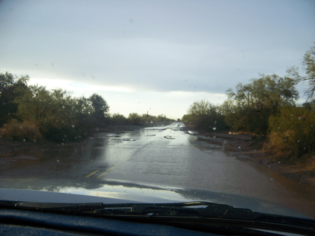


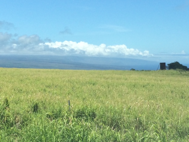
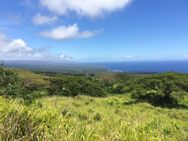

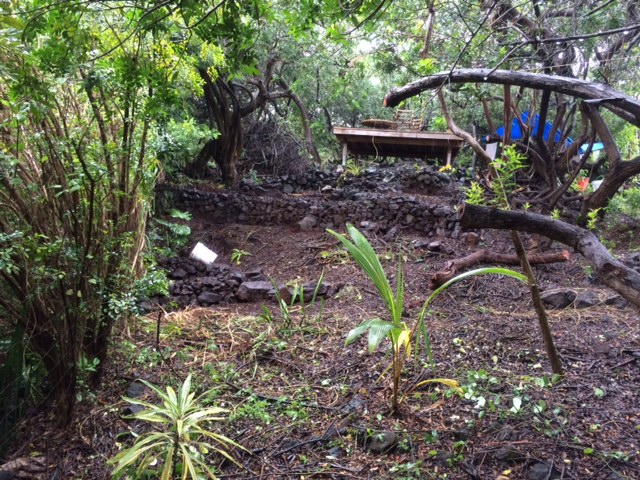
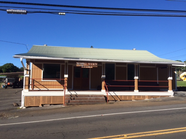
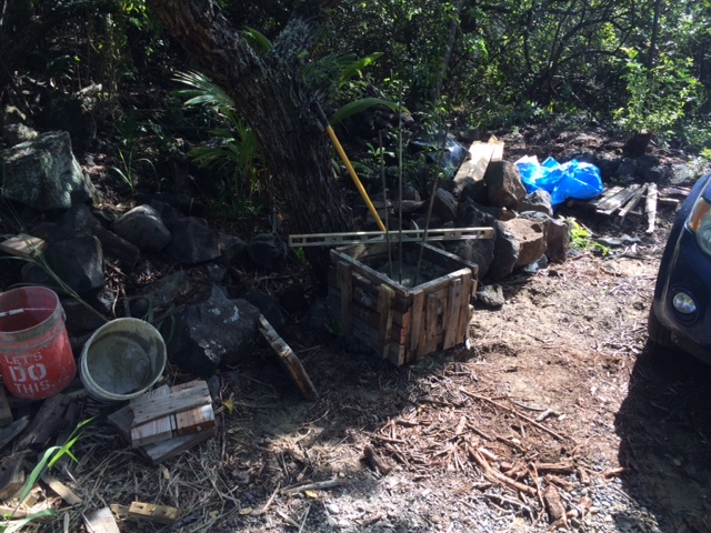
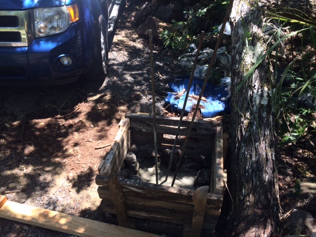
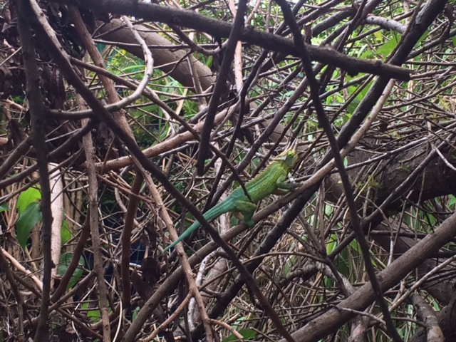

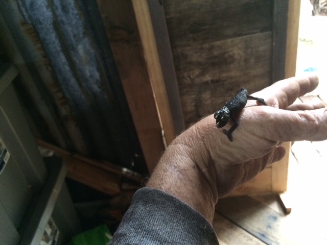
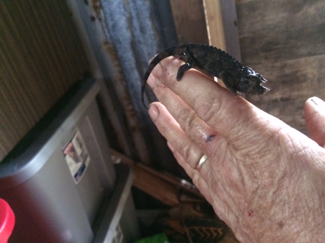
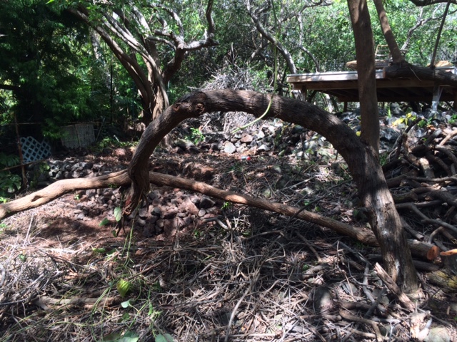
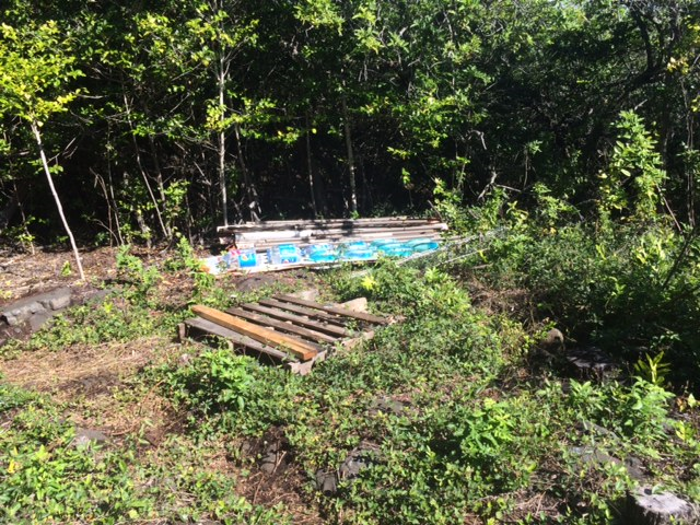
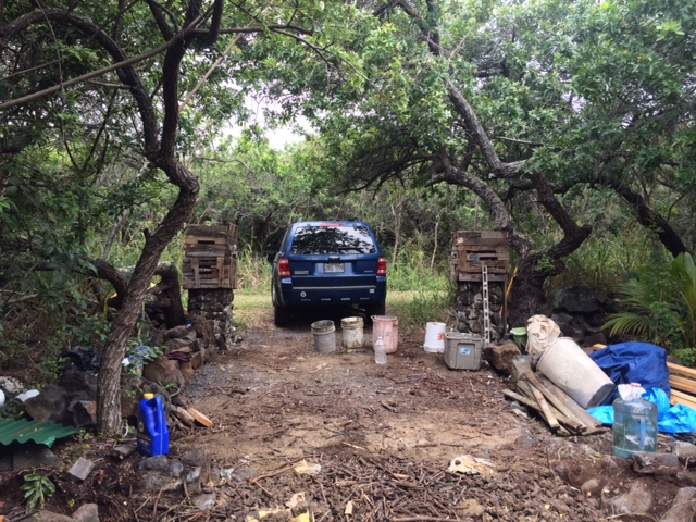


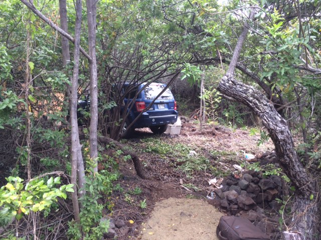
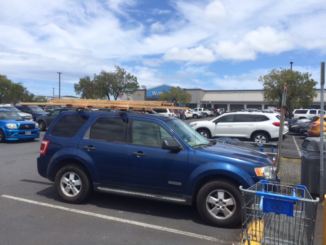
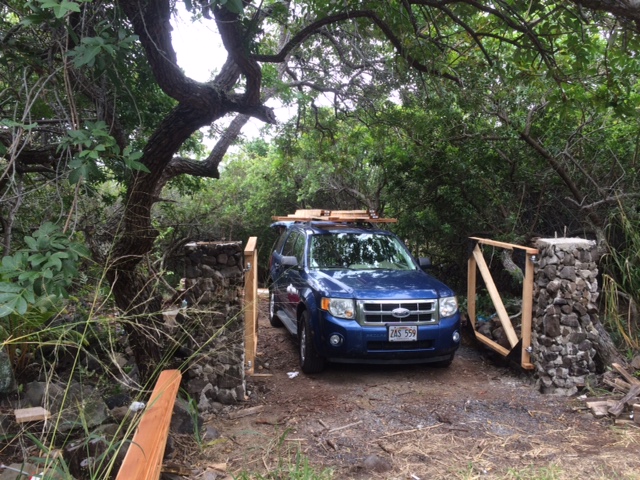

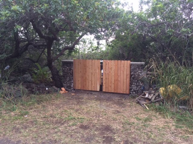
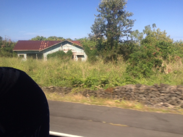
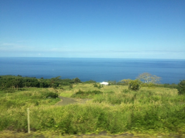
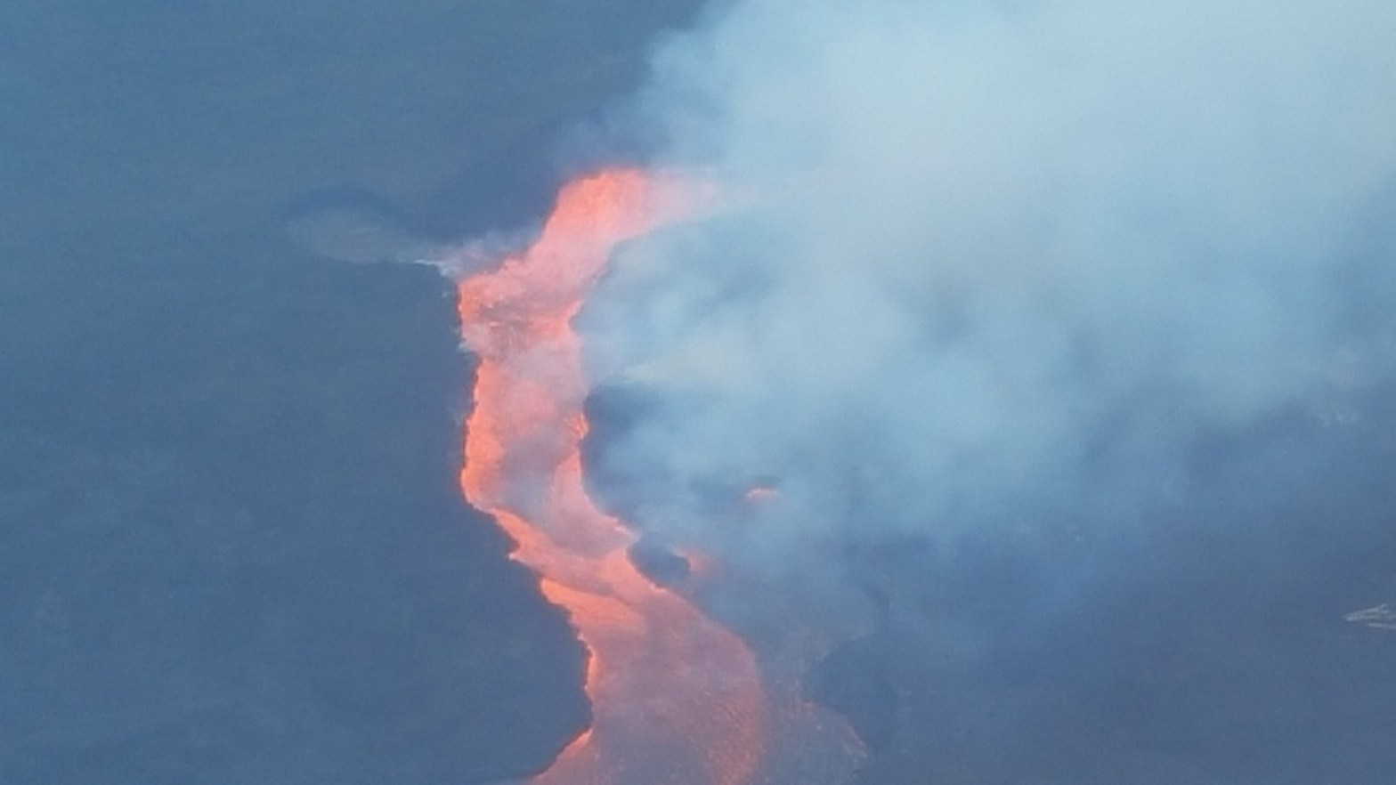
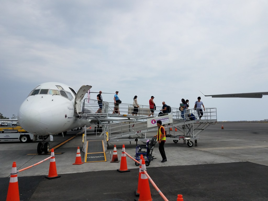
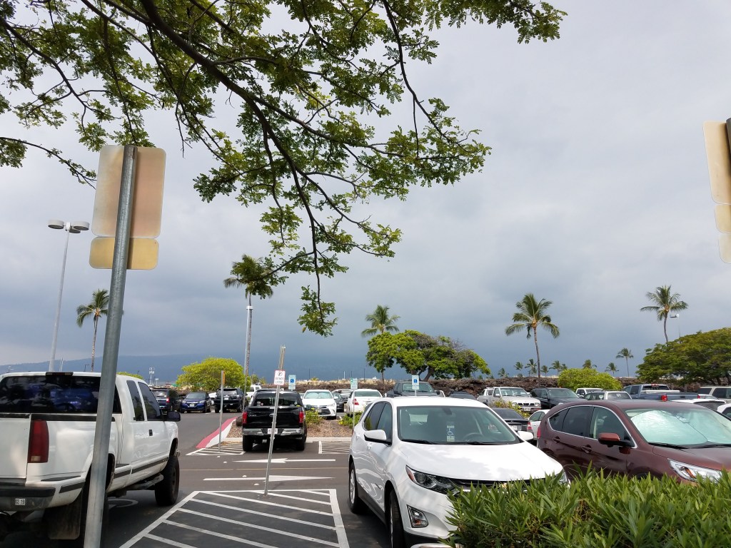
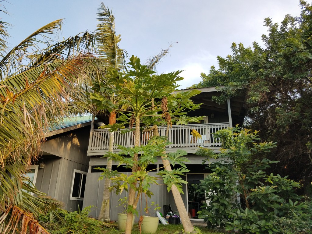

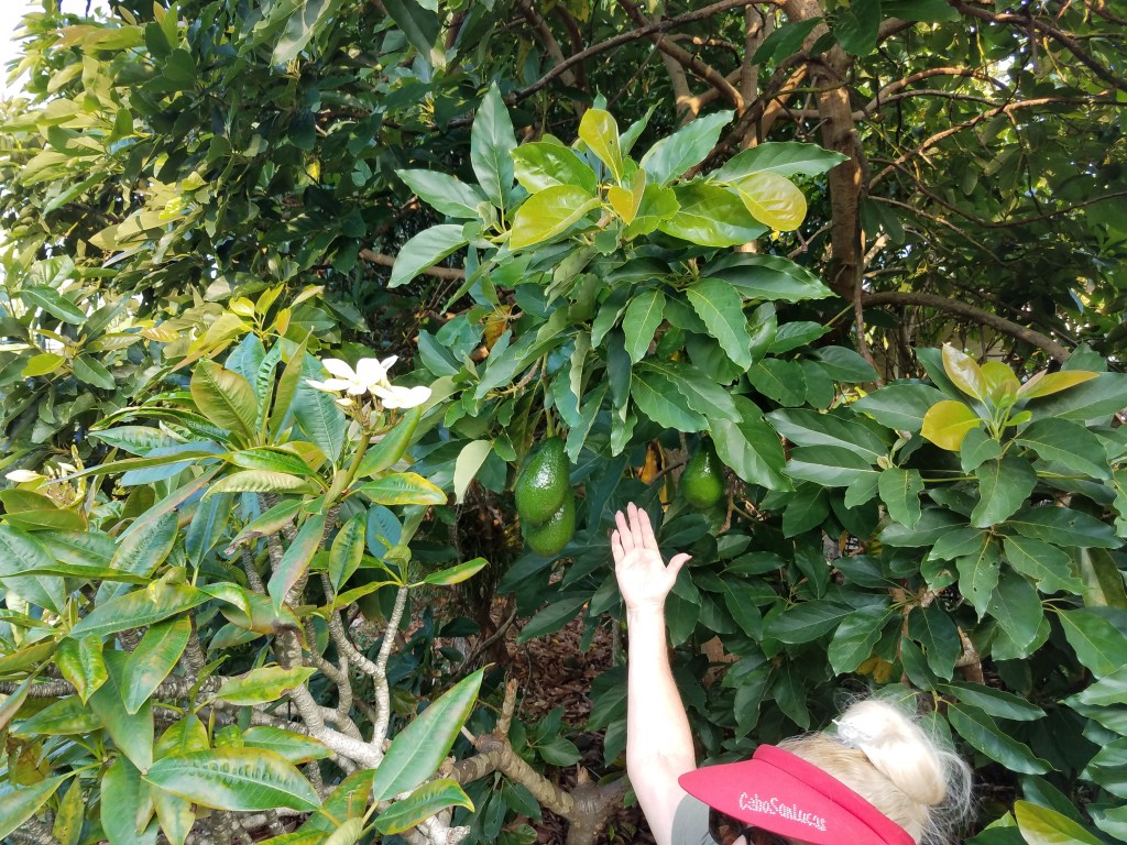


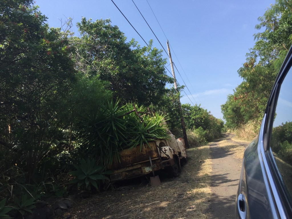
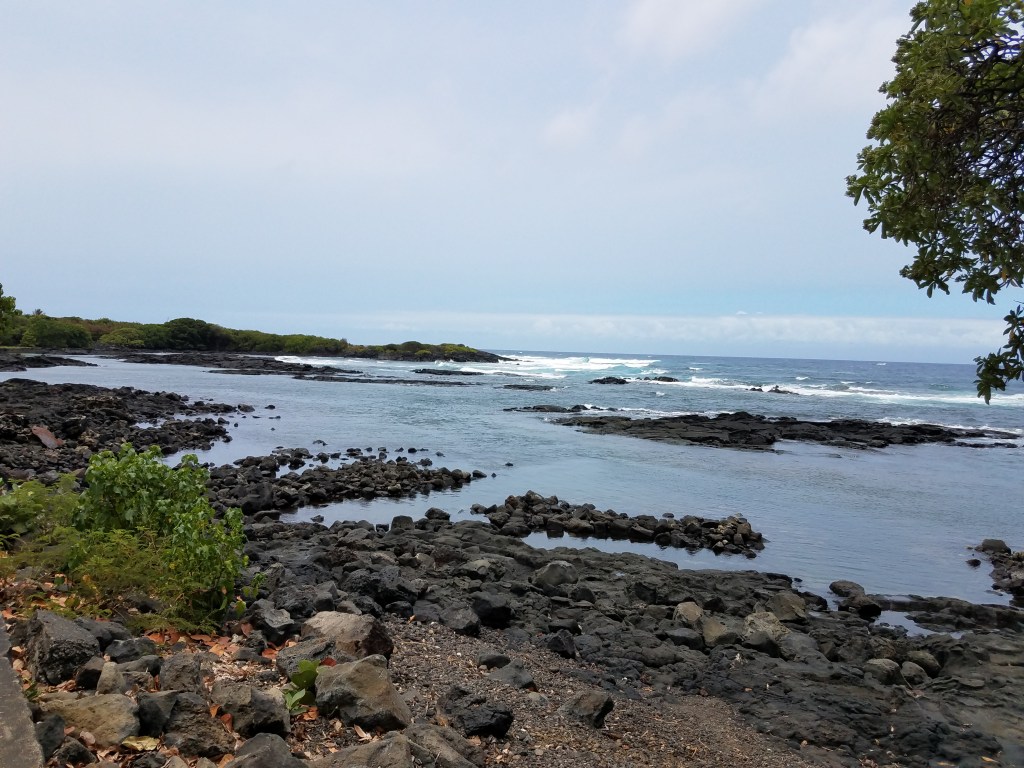

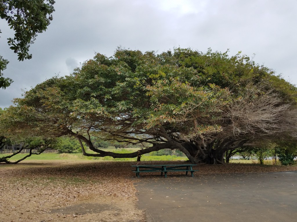

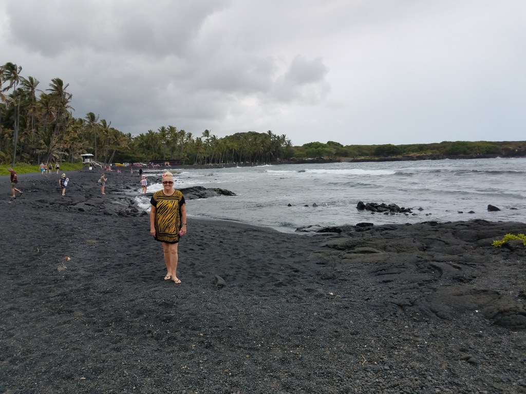

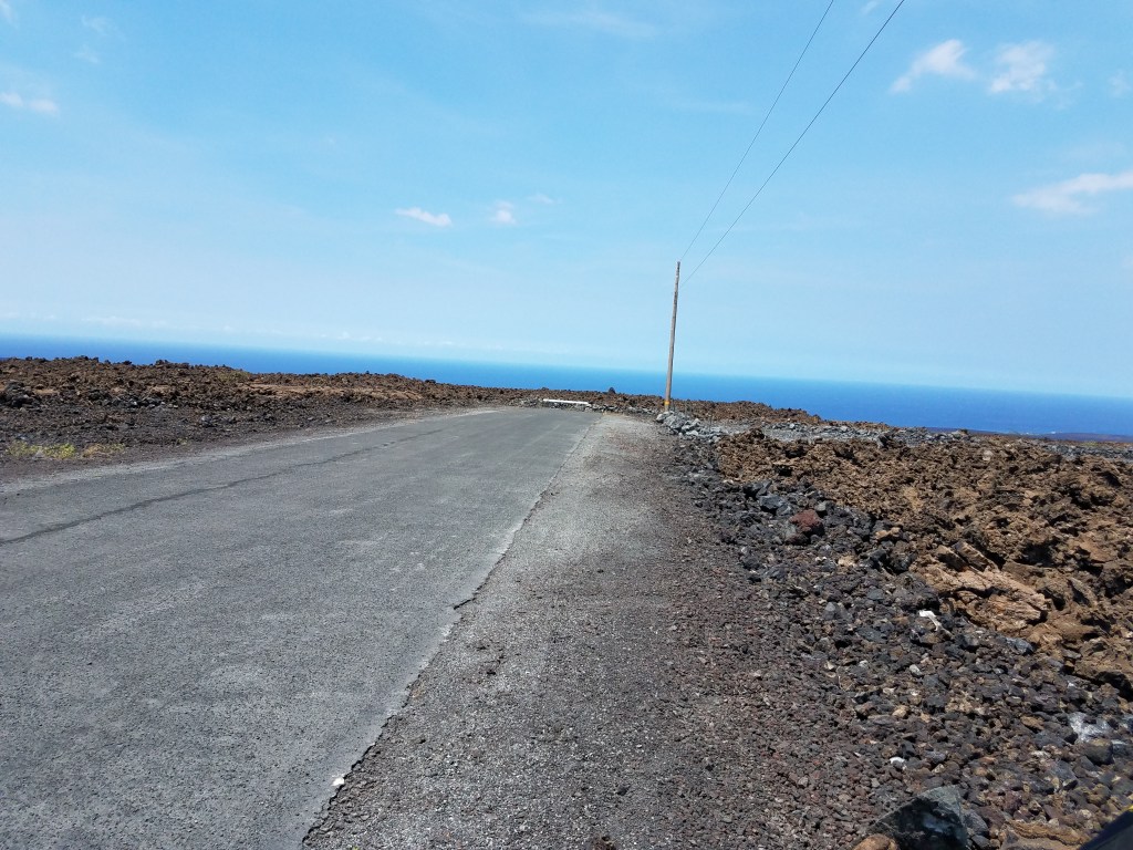
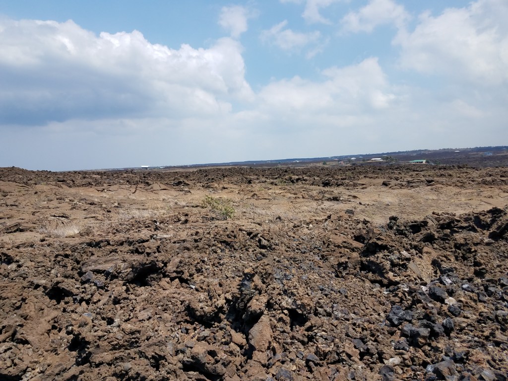

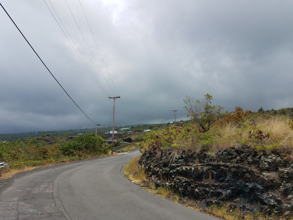


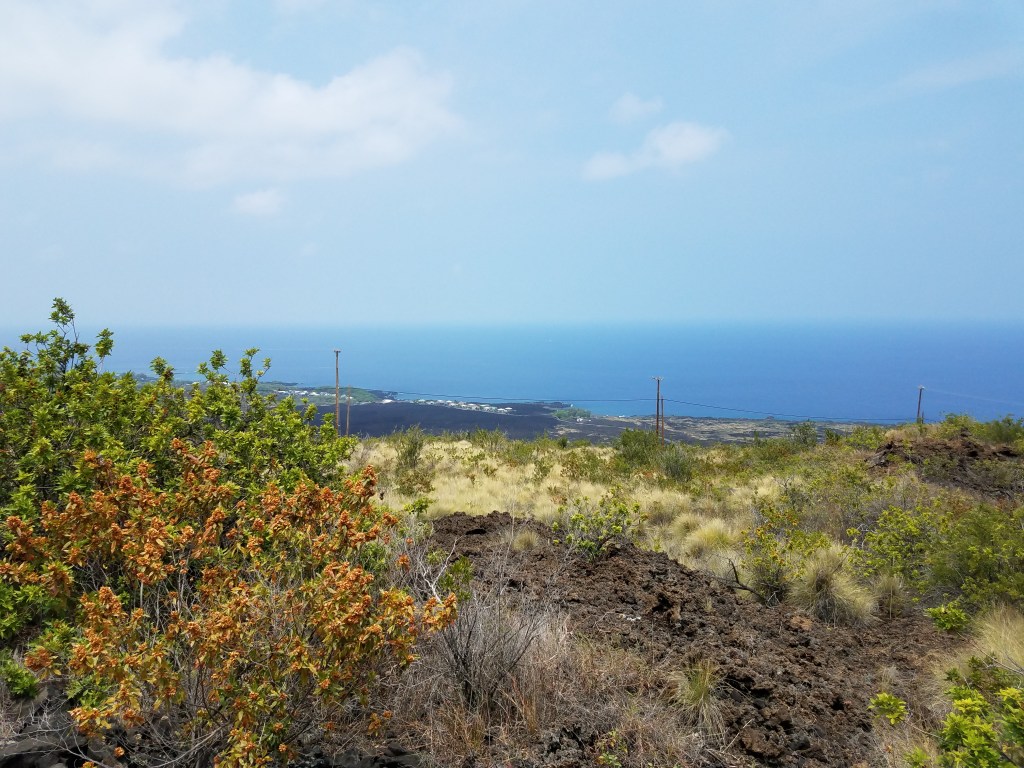
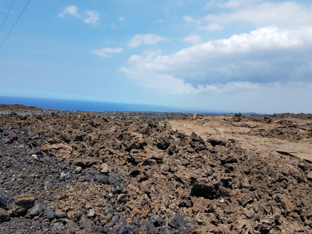
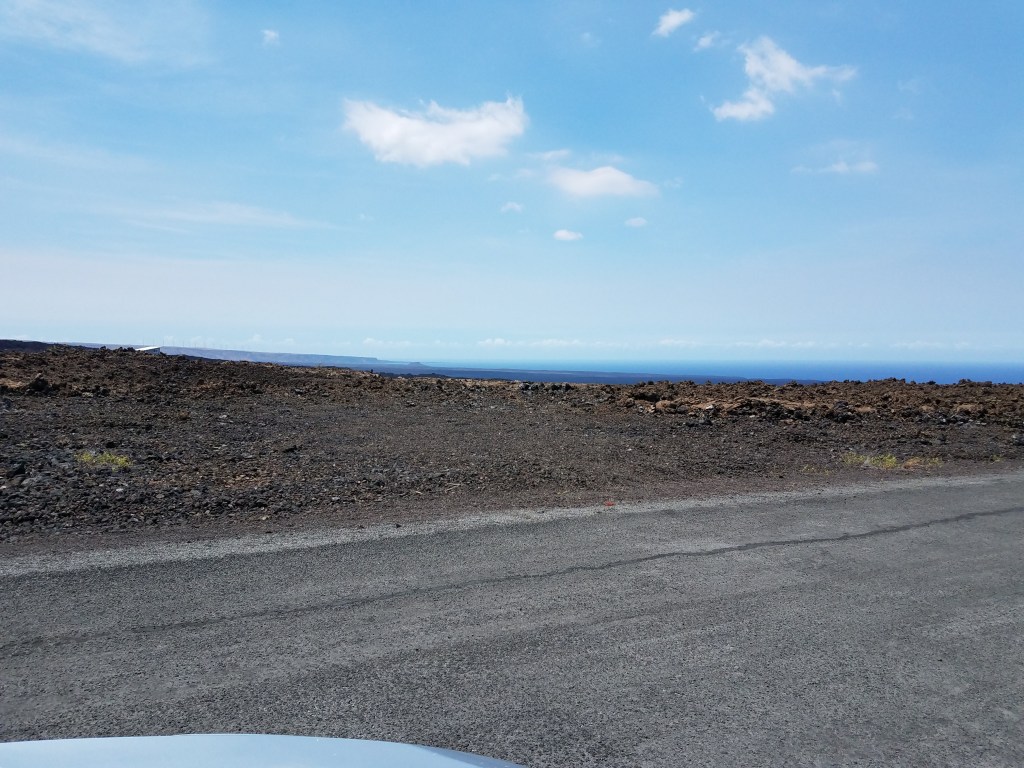

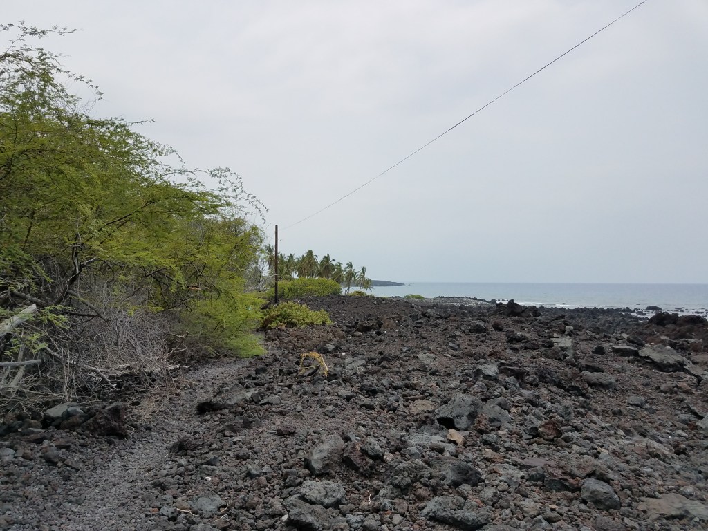
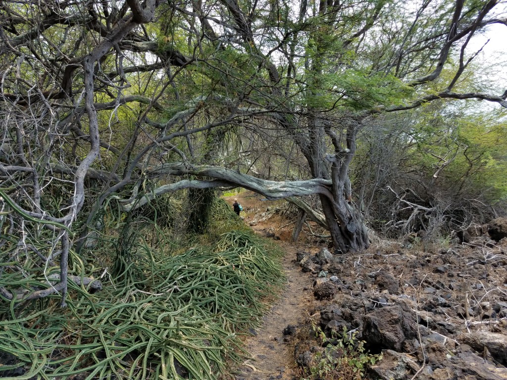

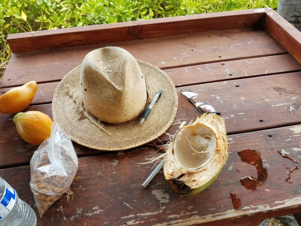


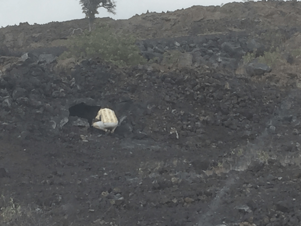
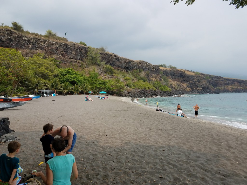


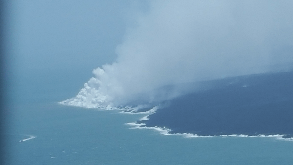
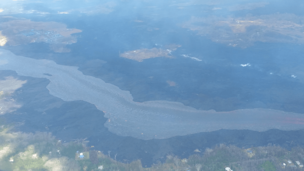


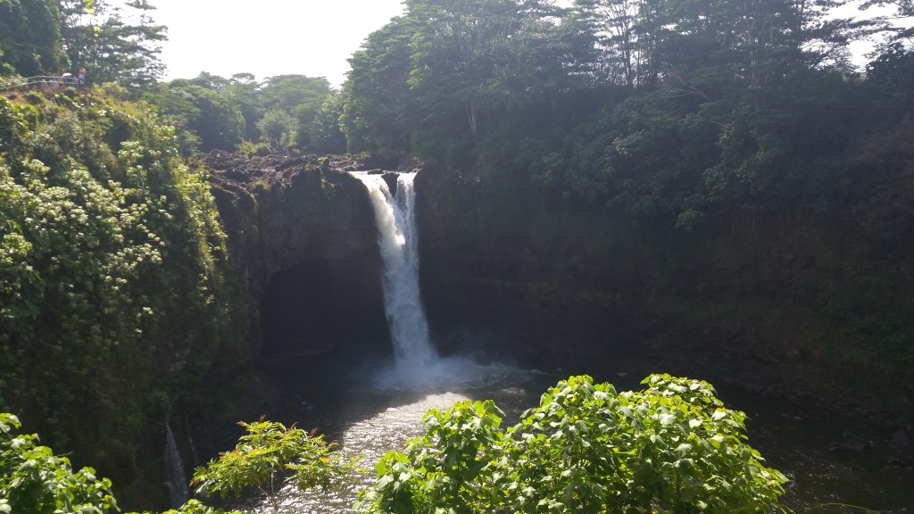
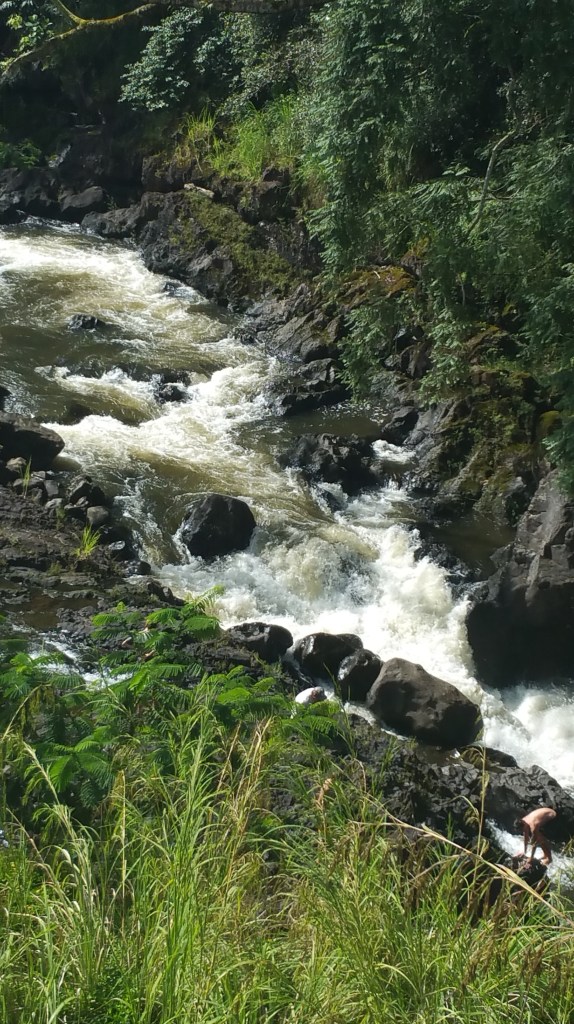
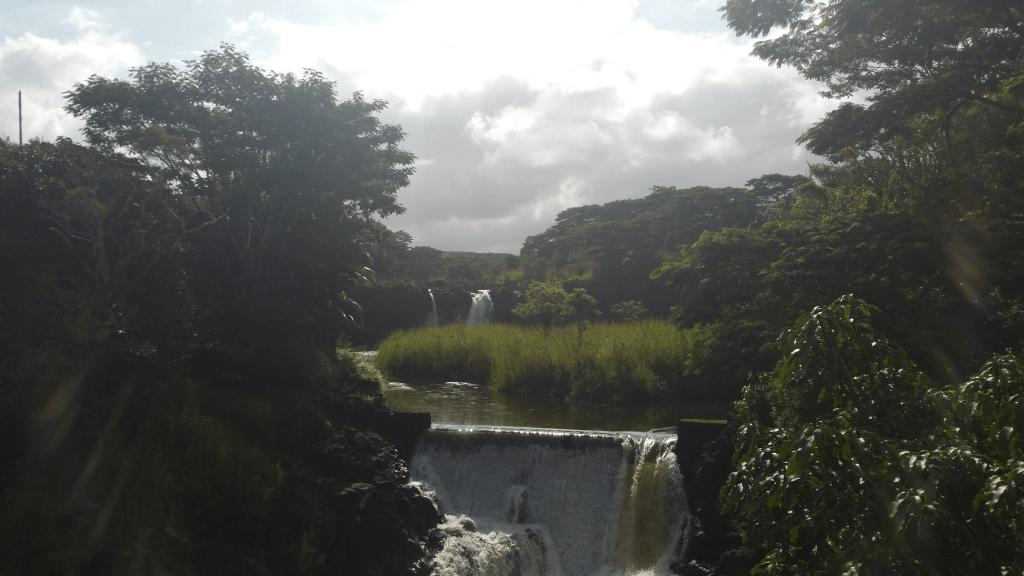


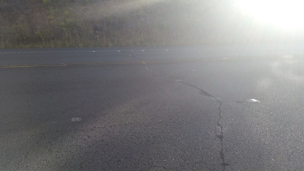
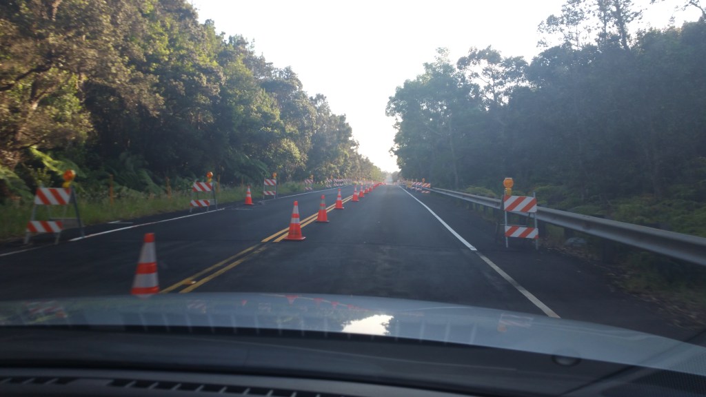

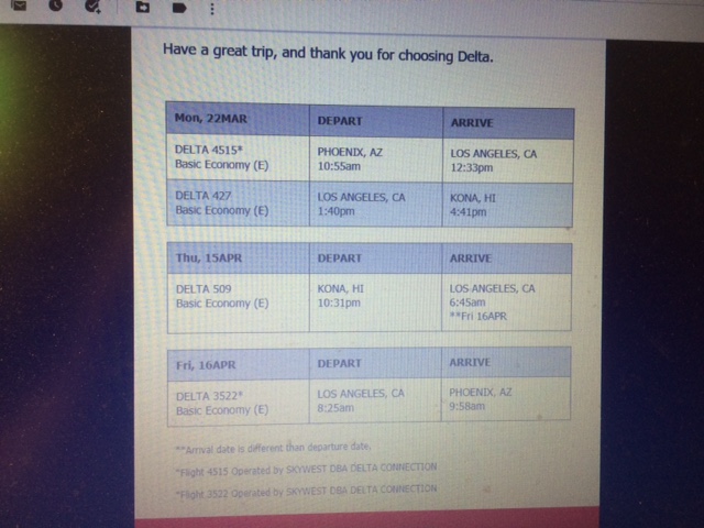
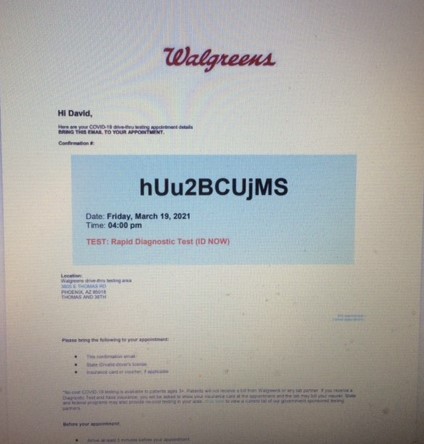
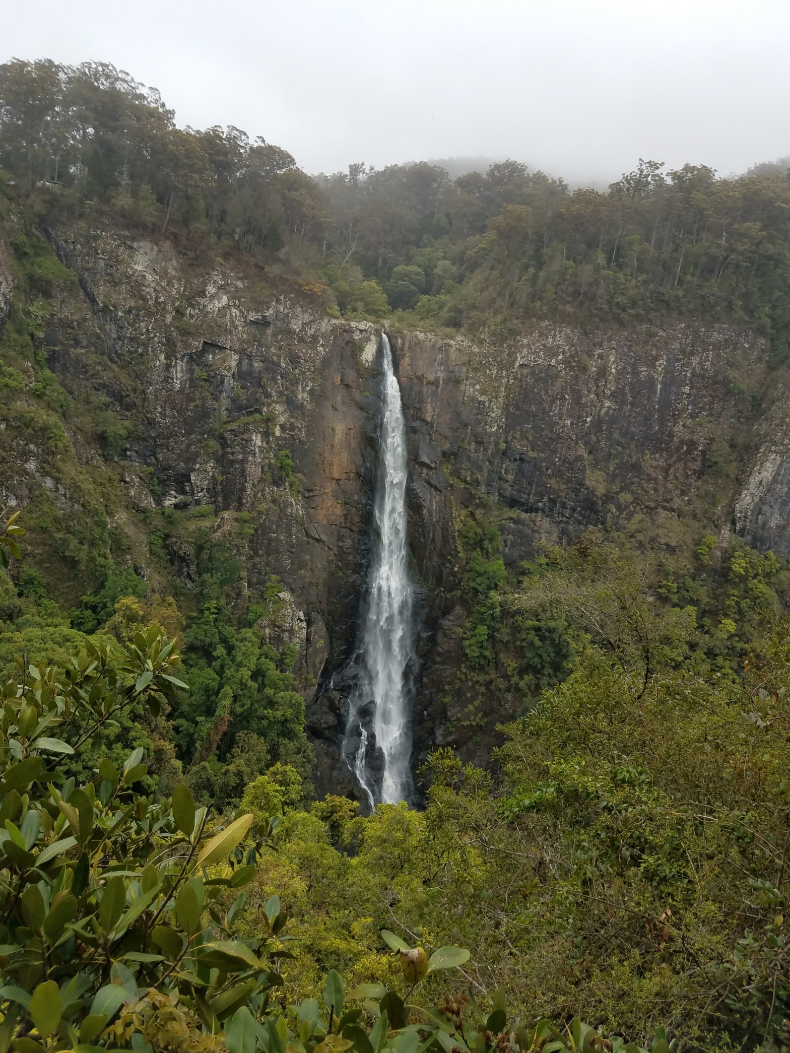


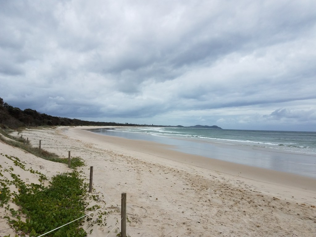
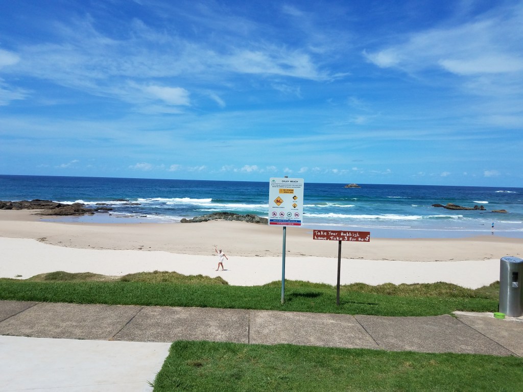
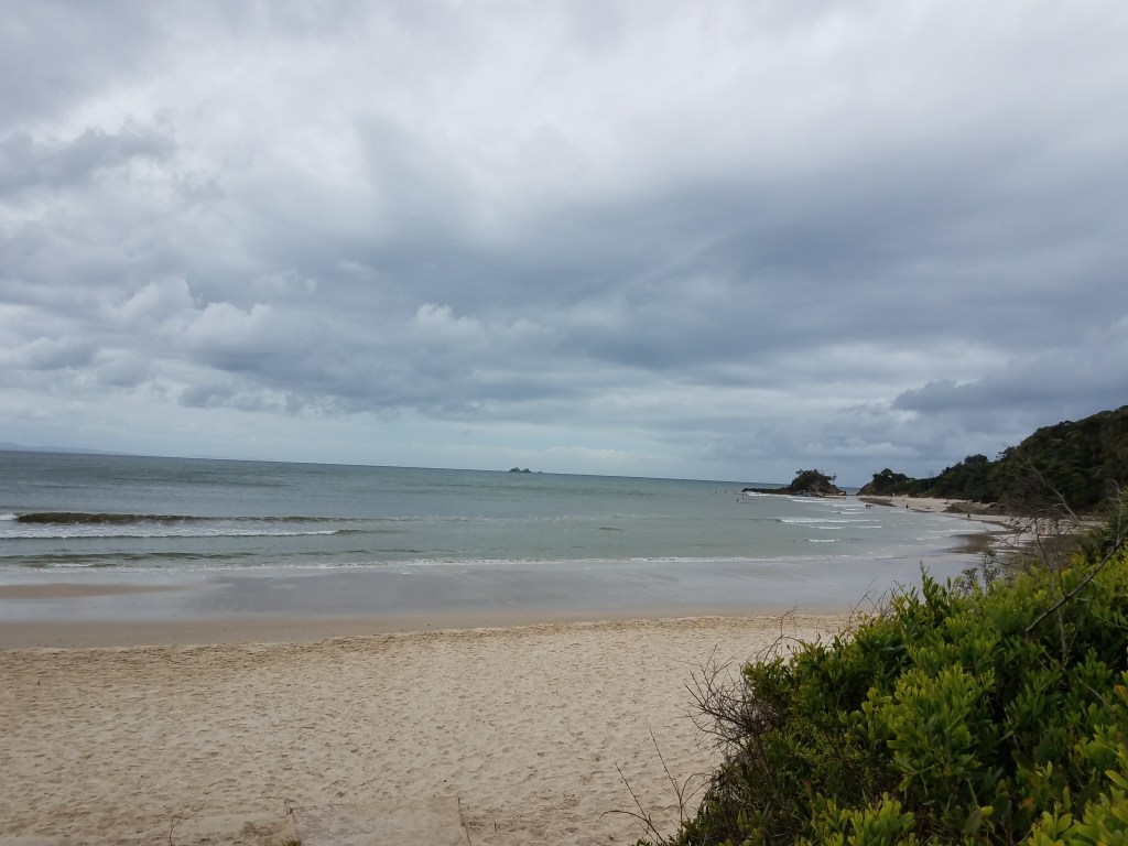

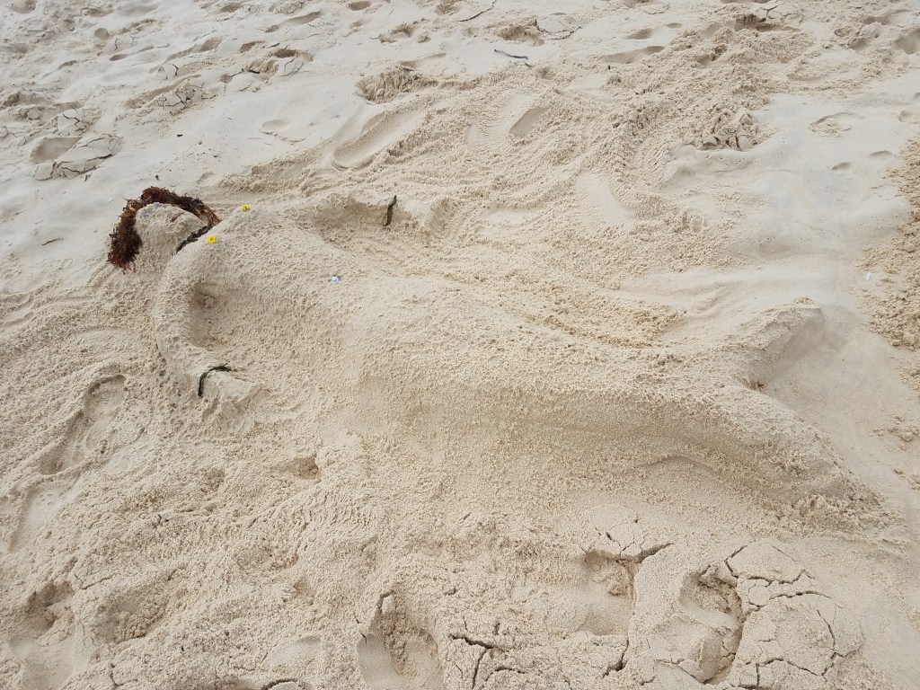


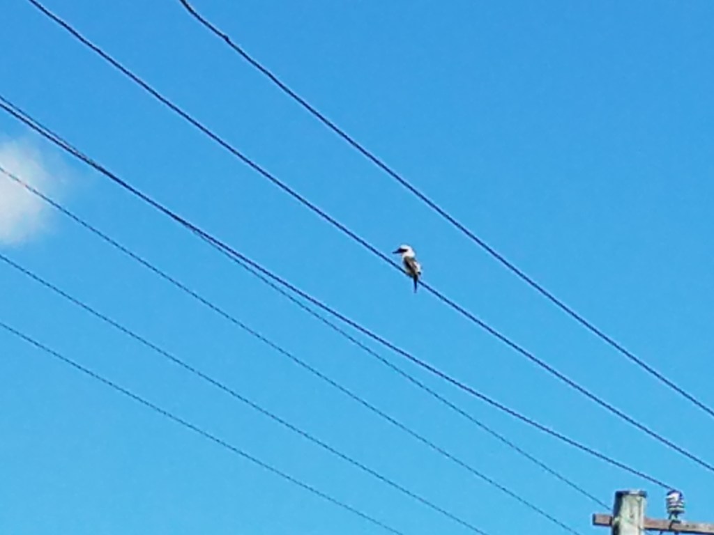

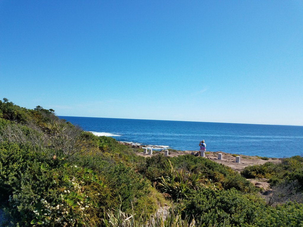
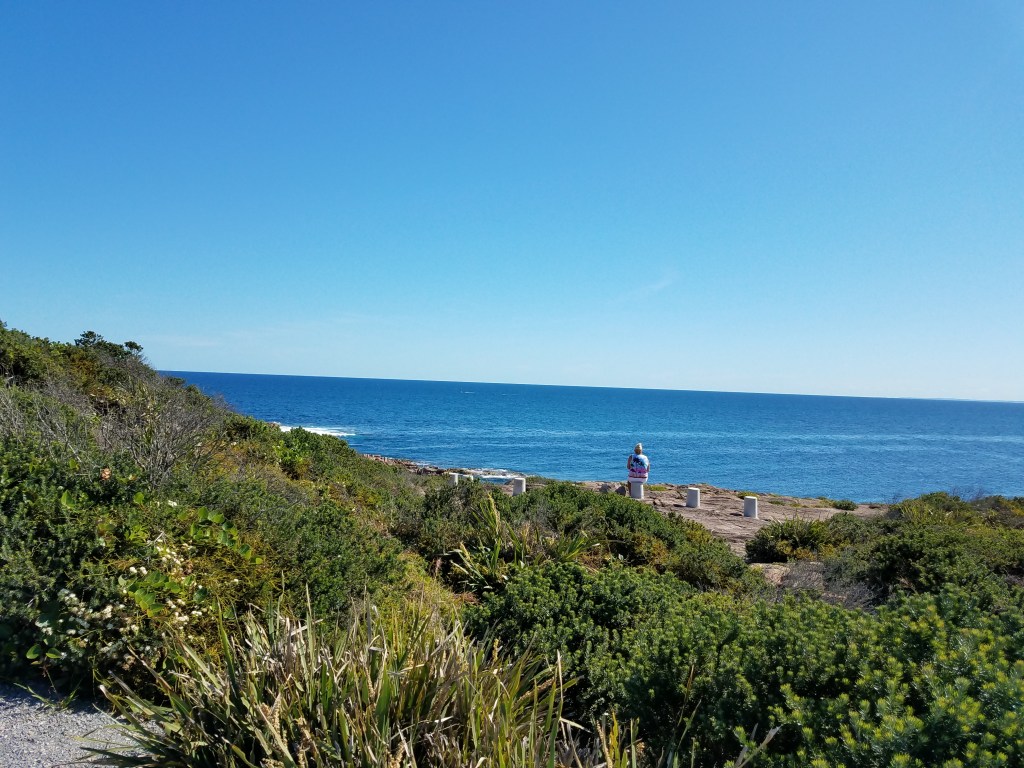
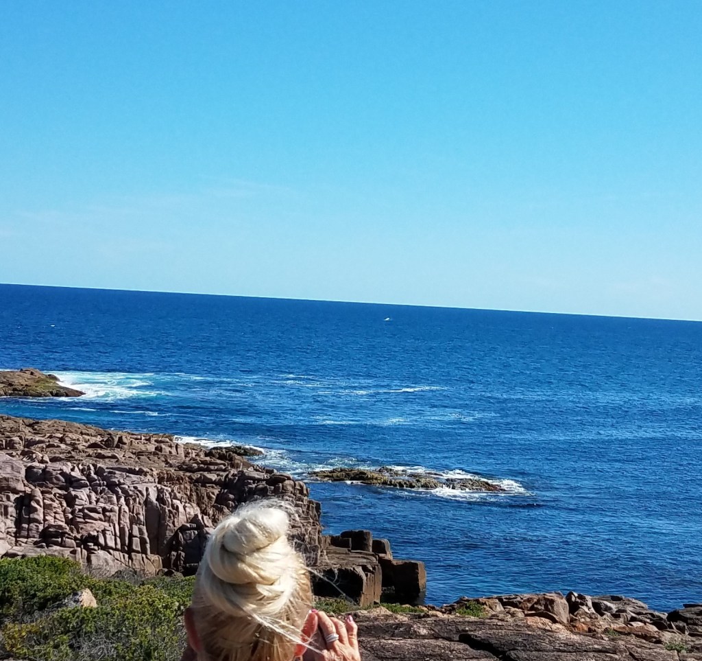
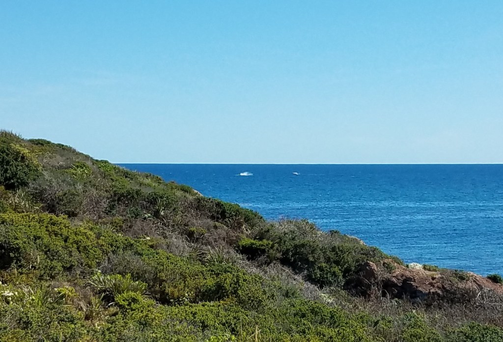


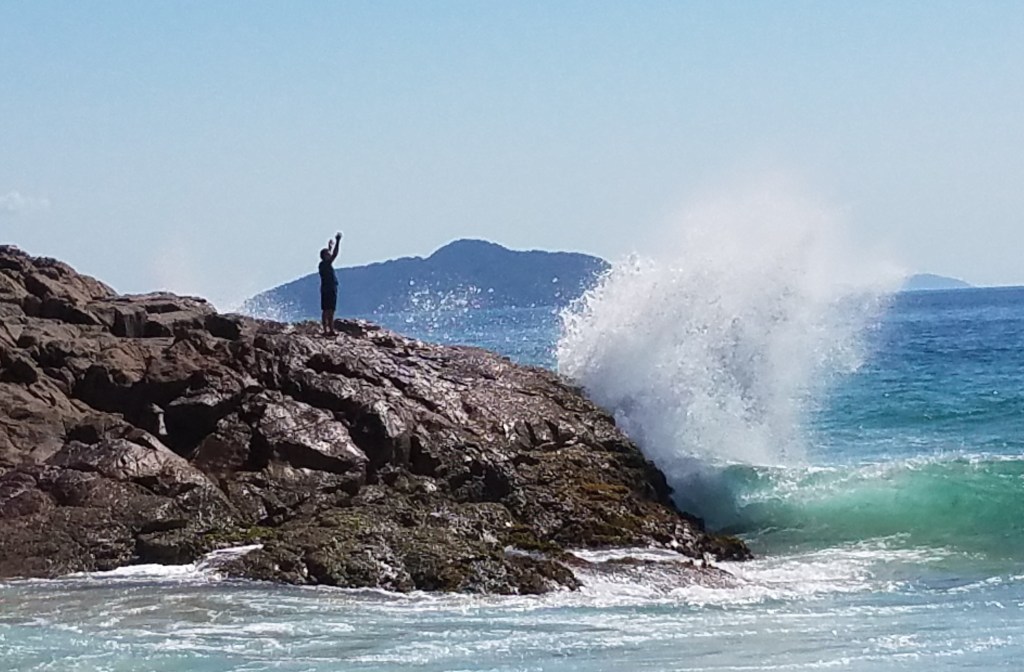
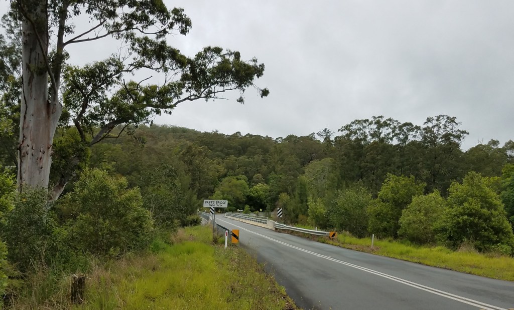
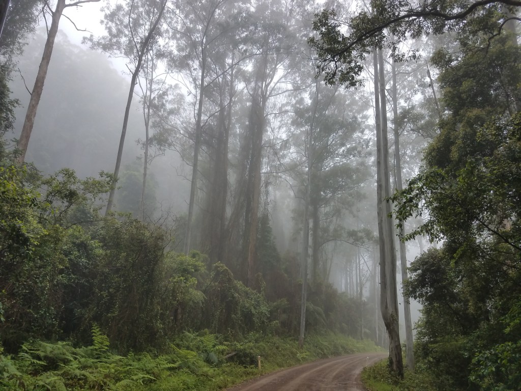
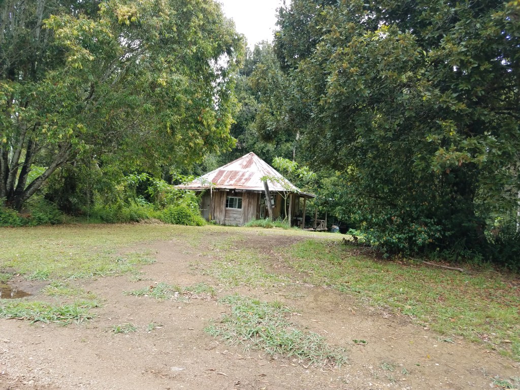
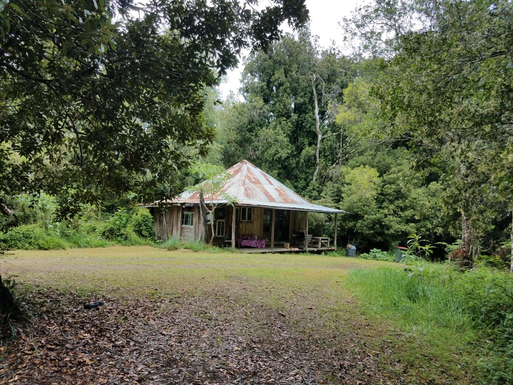


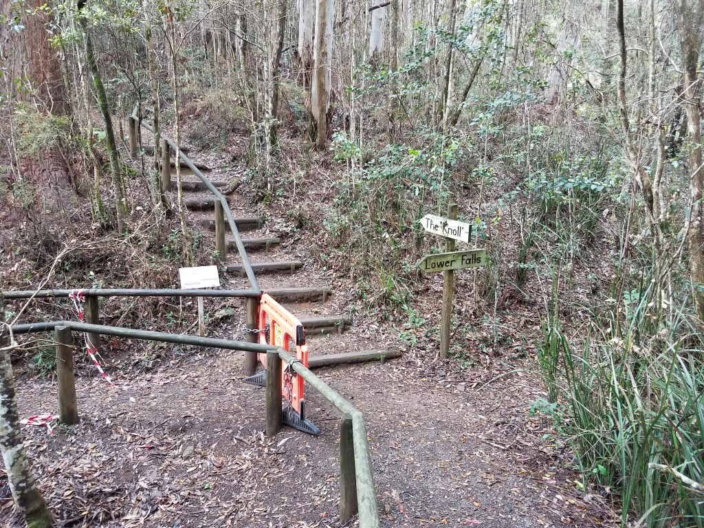
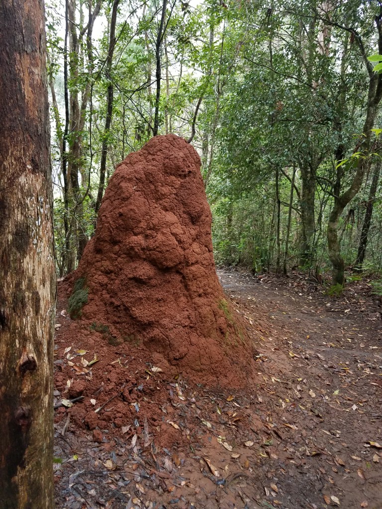
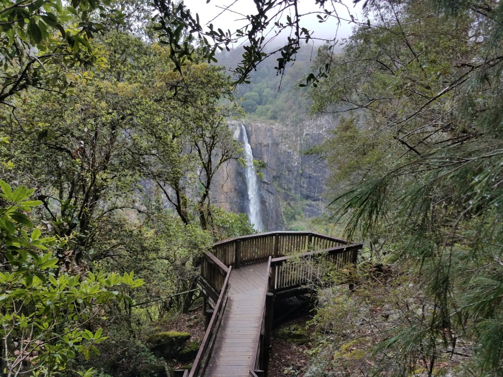

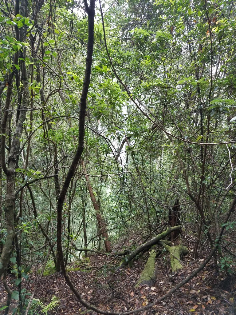
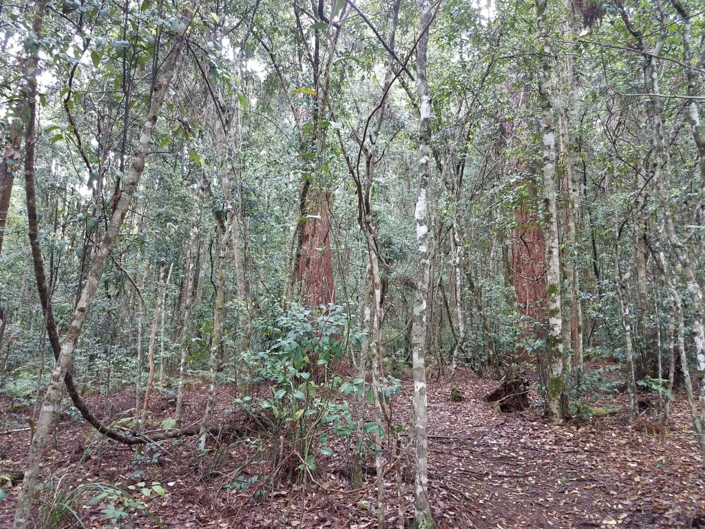


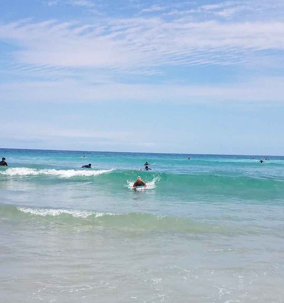
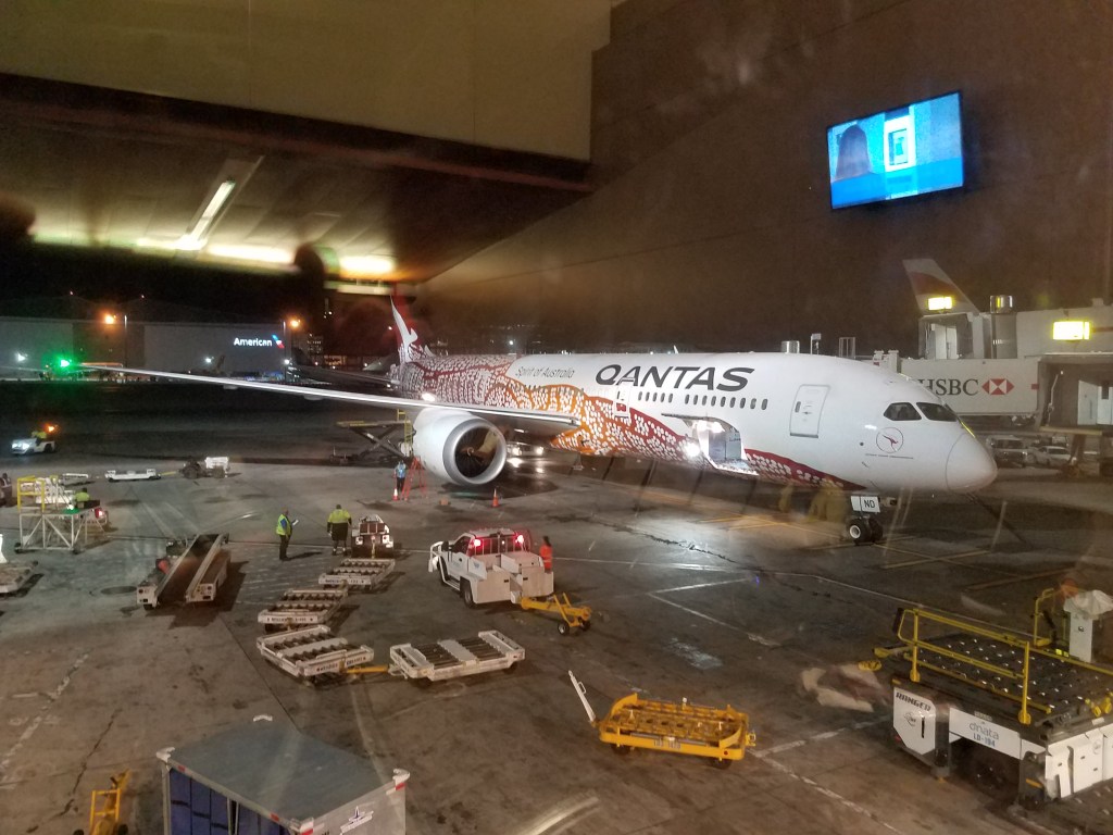
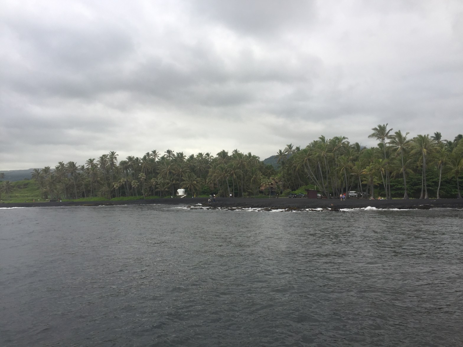
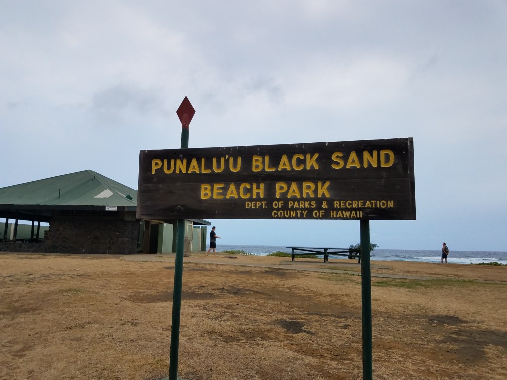
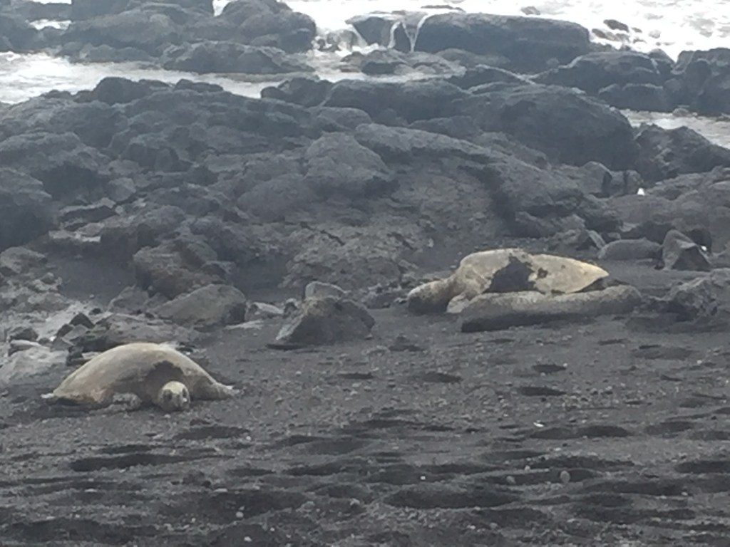

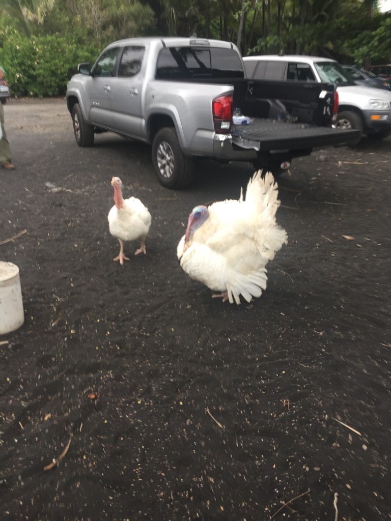
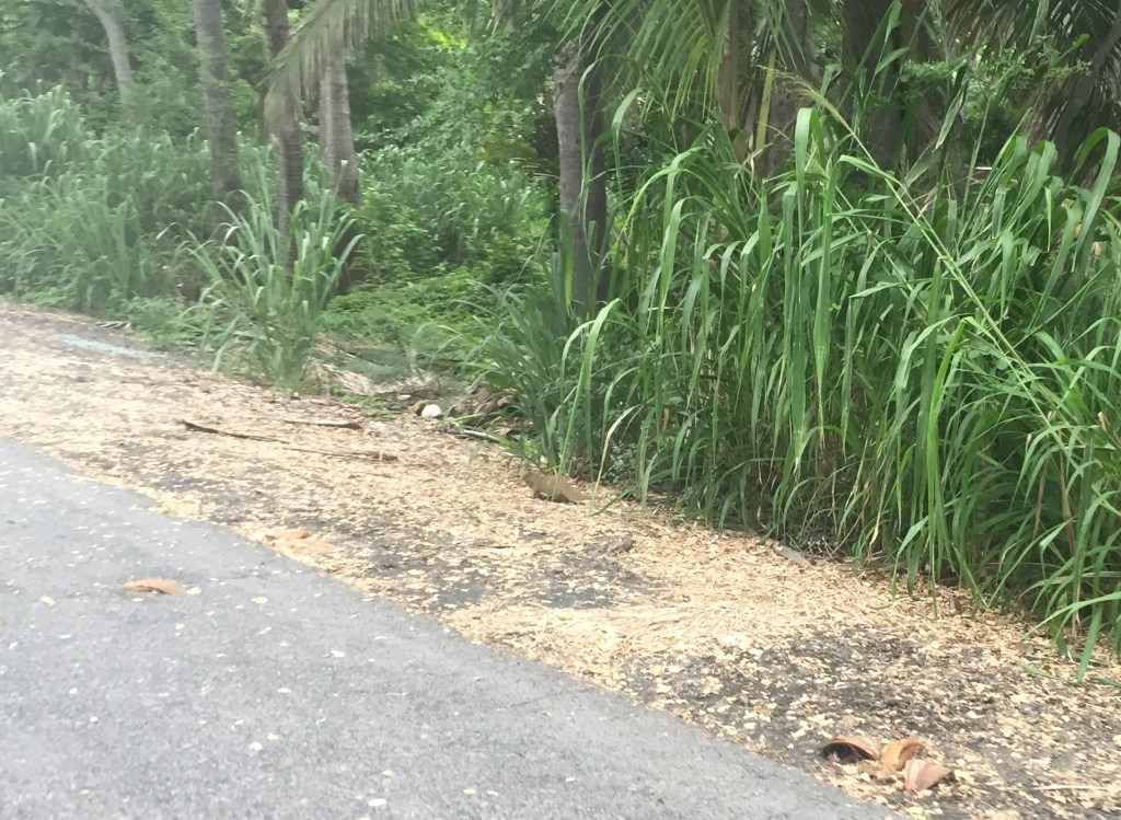
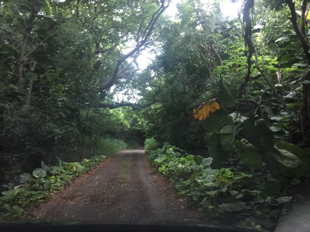
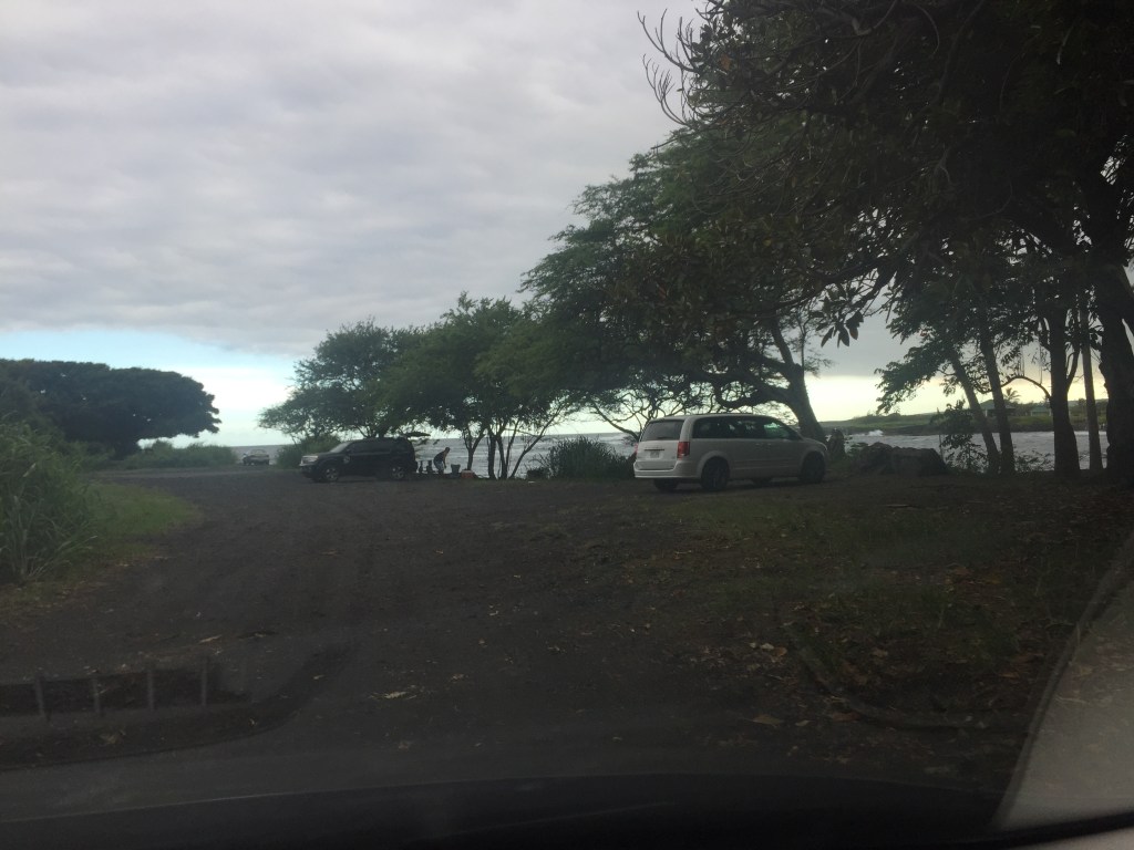

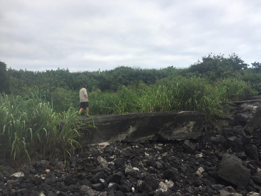
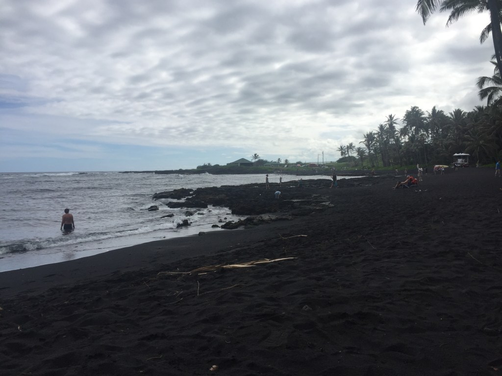
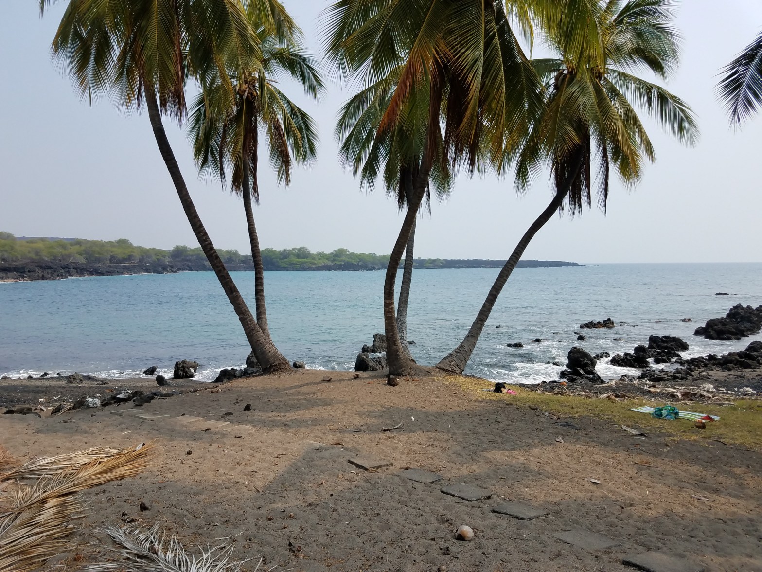


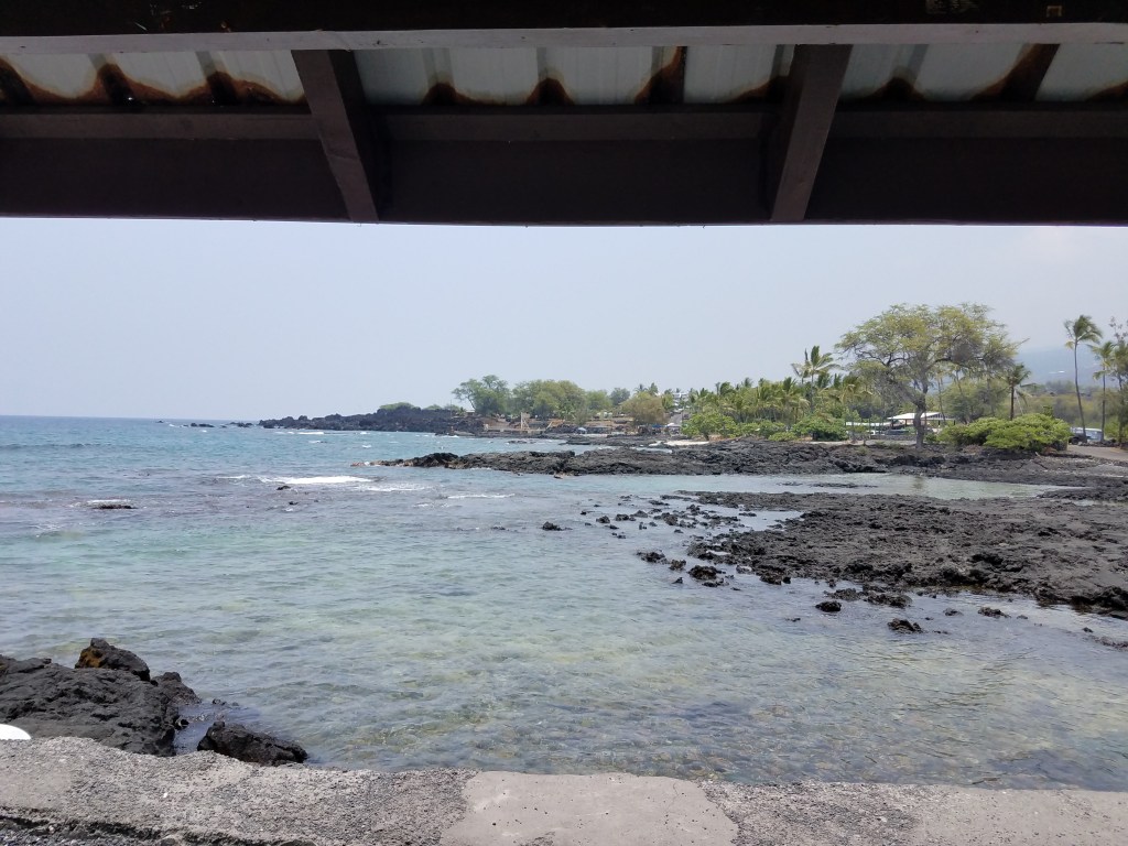

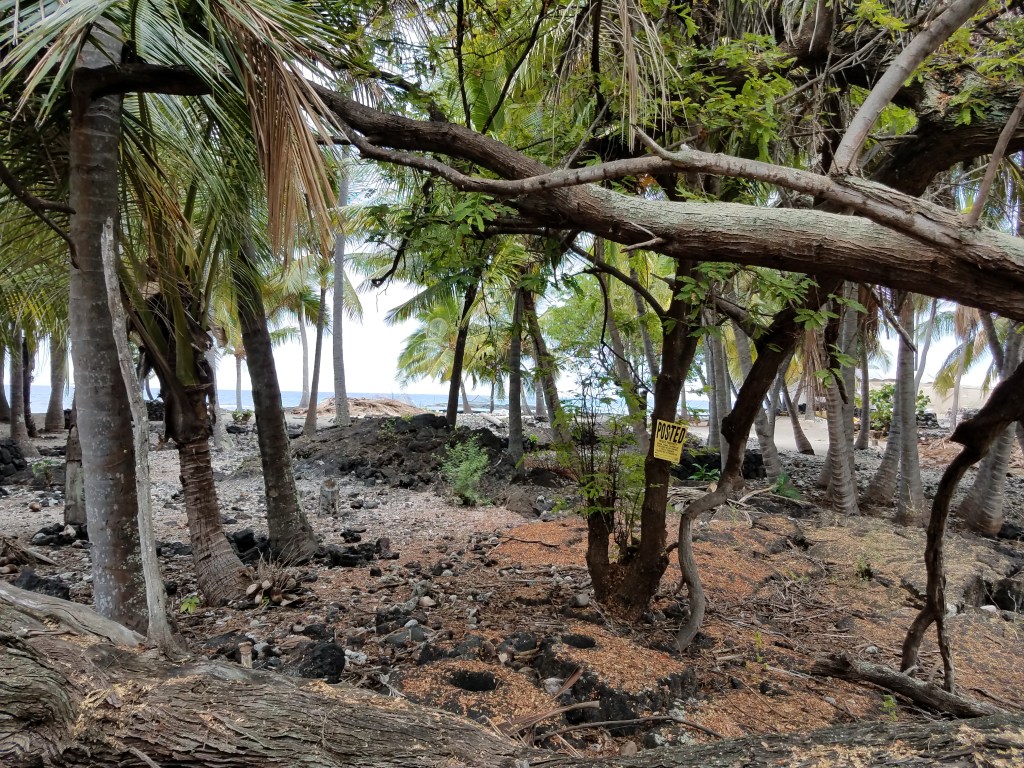


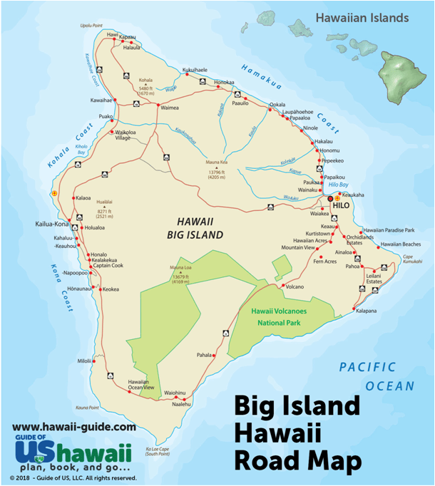
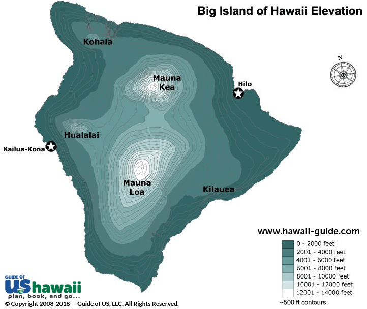
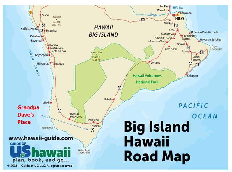
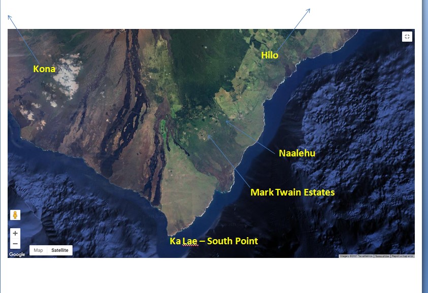
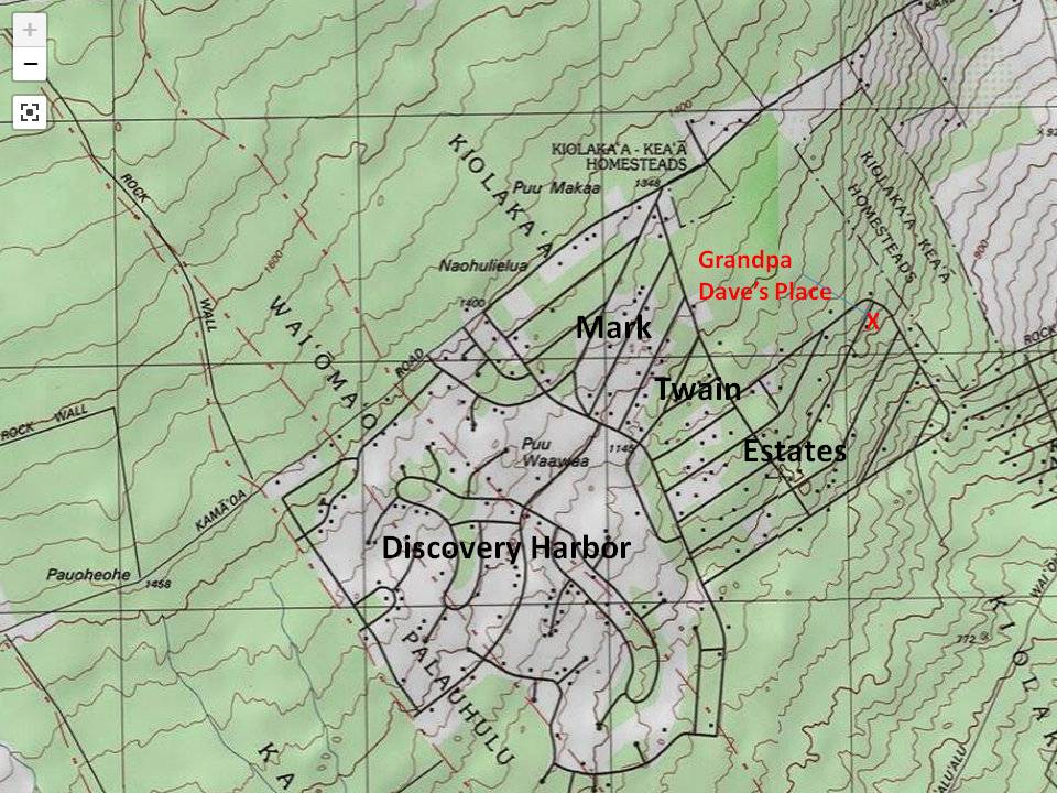


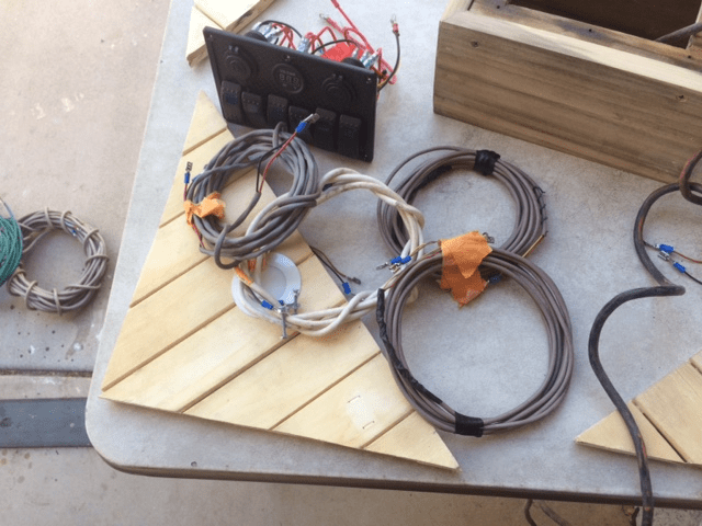
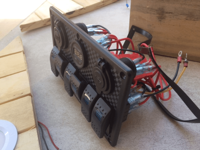
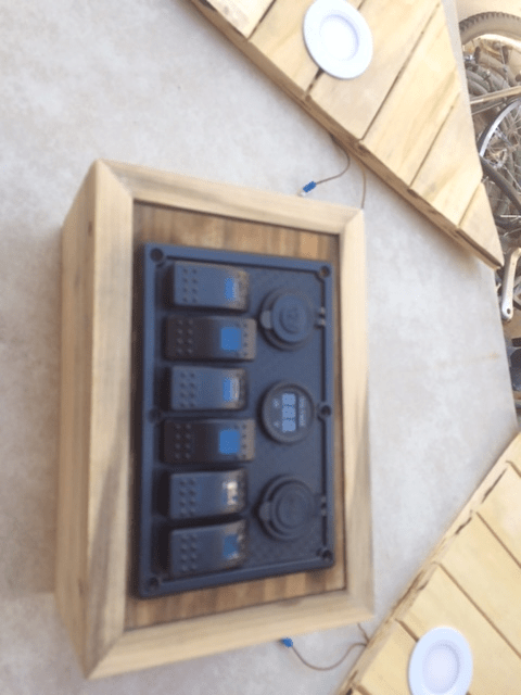
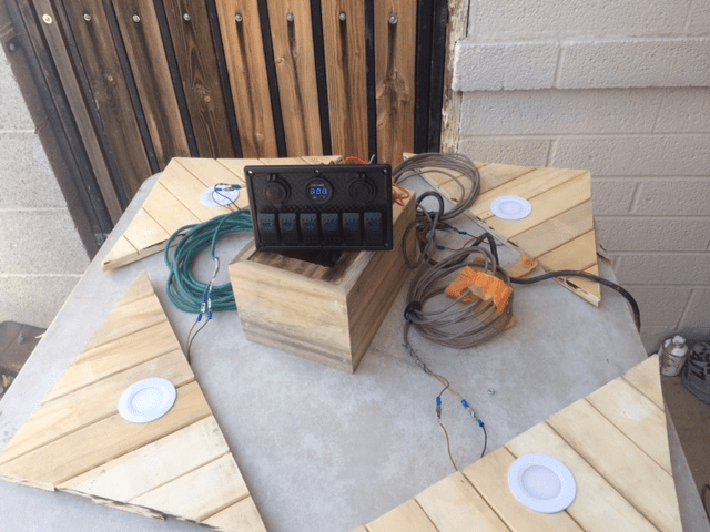
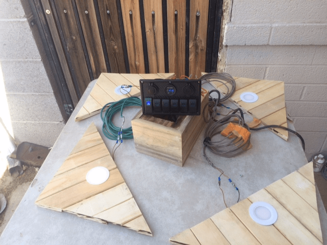
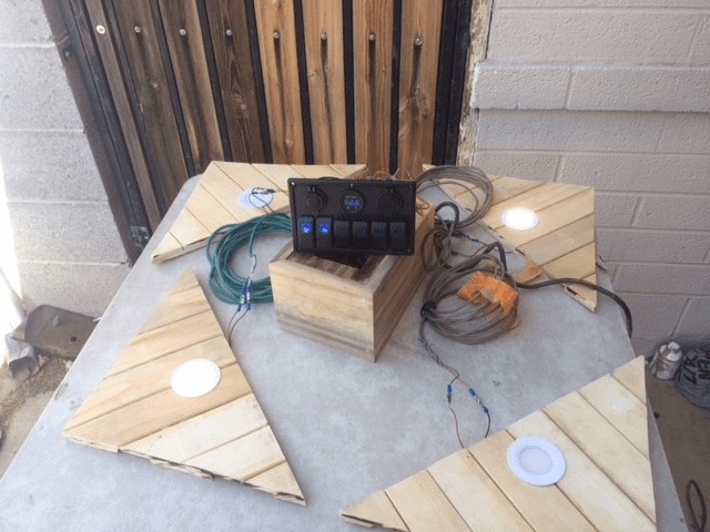
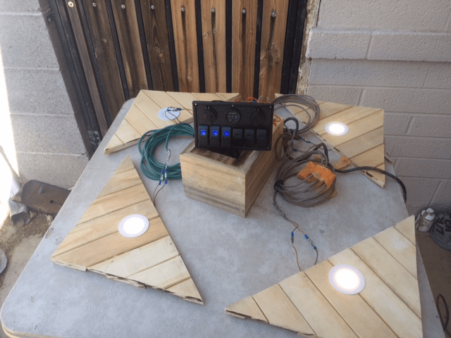

